Subsurface Hackathon project round-up, part 1

The dust has settled from the Hackathon in Paris two weeks ago. Been there, done that, came home with the T-shirt.

In the same random order they presented their 4-minute demos to our panel of esteemed judges, I present a (very) abbreviated round-up of what the teams made together over the course of the weekend. With the exception of a few teams who managed to spontaneously nucleate before the hackathon, most of these teams were comprised of people who had never met each other before the event.

Just let that sink in for a second: teams of mostly mutual strangers built 13 legit machine-learning-based geoscience applications in one weekend. 


Log Healer  

Log Healer


An automated well log management system

Team Un-well Loggers: James Wanstall (Glencore), Niket Doshi (Teradata), Joseph Taylor (Teradata), Duncan Irving (Teradata), Jane McConnell (Teradata).

Tech: Kylo (NiFi, HDFS, Hive, Spark)

If you're working with well logs, and if you've got lots of them, you've almost certainly got gaps or inaccuracies from curve to curve and from well to well. The team's scalable, automated well-log file management system Log Healer computes missing logs and heals broken ones. Amazing.


An early result from Team Janus. The image on the left is ground truth, that on the right is predicted. Many of the features are present. Not bad for v0.1!

An early result from Team Janus. The image on the left is ground truth, that on the right is predicted. Many of the features are present. Not bad for v0.1!

Meaningful cross sections from well logs

Team Janus: Daniel Buse, Johannes Camin, Paul Gabriel, Powei Huang, Fabian Kampe (all from GiGa Infosystems)

The team built an elegant machine learning workflow to attack the very hard problem of creating geologically realistic cross-section from well logs. The validation algorithm compares pixels to score the result. 


Think Section's mindblowing photomicrograph labeling tool can also make novel camouflage patterns.

Think Section's mindblowing photomicrograph labeling tool can also make novel camouflage patterns.

Paint-by-numbers on digital thin sections

Team Think Section: Diego Castaneda (Agile*), Brendon Hall (Enthought), Roeland Nieboer (Fugro), Jan Niederau (RWTH Aachen), Simon Virgo (RWTH Aachen)

Tech: Python (Scikit Learn, Scikit Image, Flask, NumPy, SciPy, Pandas), AWS for hosting app & Jupyter server.

Description: Mineral classification and point-counting on thin sections can be an incredibly tedious and time consuming task. Team Think Section trained a model to segregate, classify, and label mineral grains in 200GB of high-resolution multi-polarization-angle photomicrographs.


Team Classy's super-impressive shot gather seismic event Detection technology. Left: synthetic gather. Middle: predicted labels. Right: truth.

Team Classy's super-impressive shot gather seismic event Detection technology. Left: synthetic gather. Middle: predicted labels. Right: truth.

Event detection on seismic shot gathers

Team Classy: Princy Ikotoko Ndong (EOST), Anna Lim (NTNU), Yuriy Ivanov (NTNU), Song Hou (CGG), Justin Gosses (Valador).

Tech: Python (NumPy, Matplotlib), Jupyter notebooks.

The team created an AI which identifies and labels different events on a shot gather image. It can find direct waves, reflections, multiples or coherent noise. It uses a support vector machine for classification, and is simple and fast. 


model2seismic: An entirely new way to do modeling and inversion. Take note: the neural network that made this image knows no physics.

model2seismic: An entirely new way to do modeling and inversion. Take note: the neural network that made this image knows no physics.

Forward and inverse modeling without the physics

Team GANsters - Lukas Mosser (Imperial), Wouter Kimman (Meridian), Jesper Dramsch (Copenhagen), Alfredo de la Fuente (Wolfram), Steve Purves (Euclidity)

Tech: PyNoddy, homegrown Python ML tools.

The GANsters created a deep-learning image-translation-based seismic inversion and forward modelling system. I urge you to go and look at their project on model2seismic. If it doesn't give you goosebumps, you are geophysically inert.


Team Pick Pick Log

Team Pick Pick Log

Machine learning for for stratigraphic interpretation

Team Pick Pick LOG - Antoine Vanbesien (EOST), Fidèle Degni (Mines St-Étienne), Massinissa Mesbahi (Pau), Natsuki Gunji (Mines St-Étienne), Cédric Menut (EOST).

This team of data science and geoscience undergrads attacked an automated stratigraphic interpretation task. They used supervised learning to determine lithology from well logs in Alberta's Athabasca play, then attempted to teach their AI to pick stratigraphic tops. Impressive!


Pretty amazing, huh? The power of the hackathon to bring a project from barely-even-an-idea to actual-working-code is remarkable! And we're not even halfway through the teams: tomorrow I'll describe the other seven projects. 

Machine learning meets seismic interpretation

Agile has been reverberating inside the machine learning echo chamber this past week at EAGE. The hackathon's theme was machine learning, Monday's workshop was all about machine learning. And Matt was also supposed to be co-chairing the session on Applications of machine learning for seismic interpretation with Victor Aare of Schlumberger, but thanks to a power-cut and subsequent rescheduling, he found himself double-booked so, lucky me, he invited me to sit in his stead. Here are my highlights, from the best seat in the house.

Before I begin, I must mention the ambivalence I feel towards the fact that 5 of the 7 talks featured the open-access F3 dataset. A round of applause is certainly due to dGB Earth Sciences for their long time stewardship of open data. On the other hand, in the sardonic words of my co-chair Victor Aarre, it would have been quite valid if the session was renamed The F3 machine learning session. Is it really the only quality attribute research dataset our industry can muster? Let's do better.

Using seismic texture attributes for salt classification

Ghassan AlRegib ruled the stage throughout the session with not one, not two, but three great talks on behalf of himself and his grad students at Georgia Institute of Technology (rather than being a show of bravado, this was a result of problems with visas). He showed some exciting developments in shallow learning methods for predicting facies in seismic data. In addition to GLCM attributes, he also introduced a couple of new (to me anyway) attributes for salt classification. Namely, textural gradient and a thing he called seismic saliency, a metric modeled after the human visual system describing the 'reaction' between relative objects in a 3D scene. 

Twelve Seismic attributes used for multi-attribute salt-boundary classification. (a) is RMS Amplitude, (B) to (M) are TEXTURAL attributes. See abstract for details. This figure is copyright of Ghassan AlRegib and licensed CC-BY-SA by virtue of being generated from the F3 dataset of dGB and TNO.

Ghassan also won the speakers' lottery, in a way. Due to the previous day's power outage and subsequent reshuffle, the next speaker in the schedule was a no-show. As a result, Ghassan had an extra 20 minutes to answer questions. Now for most speakers that would be a public-speaking nightmare, but Ghassan hosted the onslaught of inquiring minds beautifully. If we hadn't had to move on to the next next talk, I'm sure he could have entertained questions all afternoon. I find it fascinating how unpredictable events like power outages can actually create the conditions for really effective engagement. 

Salt classification without using attributes (using deep learning)

Matt reported on Anders Waldeland's work a year ago, and it was interesting to see how his research has progressed, as he nears the completion of his thesis. 

Anders successfully demonstrated how convolutional neural networks (CNNs) can classify salt bodies in seismic datasets. So, is this a big deal? I think it is. Indeed, Anders's work seems like a breakthough in seismic interpretation, at least of salt bodies. To be clear, I don't think this means that it is time for seismic interpreters to pack up and go home. But maybe we can start looking forward to spending our time doing less tedious things than picking complex salt bodies.  
One slice of a 3d seismic volume with two CLASS LABELS: Salt (red) and Not SALT (GREEN). This is the training data. On the right: Extracted 3D salt body in the same dataset, coloured by elevation. Copyright of A Waldeland, used with permission.

One slice of a 3d seismic volume with two CLASS LABELS: Salt (red) and Not SALT (GREEN). This is the training data. On the right: Extracted 3D salt body in the same dataset, coloured by elevation. Copyright of A Waldeland, used with permission.

He trained a CNN on one manually labeled slice of a 3D cube and used the network to automatically classify the full 3D salt body (on the right in the figure). Conventional algorithms for salt picking, such as that used by AlRegib (see above), typically rely on seismic attributes to define a feature space. This requires professional insight and judgment, and is prone to error and bias. Nicolas Audebert mentioned the same shortcoming in his talk in the workshop Matt wrote about last week. In contrast, the CNN algorithm works directly on the seismic data, learning the most discriminative filters on its own, no attributes needed

Intuition training

Machine learning isn't just useful for computing in the inverse direction such as with inversion, seismic interpretation, and so on. Johannes Amtmann showed us how machine learning can be useful for ranking the performance of different clustering methods using forward models. It was exciting to see: we need to get back into the habit of forward modeling, each and every one of us. Interpreters build synthetics to hone their seismic intuition. It's time to get insanely good at building forward models for machines, to help them hone theirs. 

There were so many fascinating problems being worked on in this session. It was one of the best half-day sessions of technical content I've ever witnessed at a subsurface conference. Thanks and well done to everyone who presented.


Machine learning and analytics in geoscience

We're at EAGE in Paris. I'm sitting in a corner of the exhibition because the power is out in the main hall, so all the talks for the afternoon have been postponed. The poor EAGE team must be beside themselves, I feel for them. (Note to future event organizers: white boards!)

Yesterday Diego, Evan, and I — along with lots of hackathon participants — were at the Data Science for Geosciences workshop, an all-day machine learning fest. The session was chaired by Cyril Agut (Total), Marianne Cuif-Sjostrand (Total), Florence Delprat-Jannaud (IFPEN), and Noalwenn Dubos-Sallée (IFPEN), and they had assembled a good programme, with quite a bit of variety.

Michel Lutz, Group Data Officer at Total, and adjunct at École des Mines de Saint-Étienne, gave a talk entitled, Data science & application to geosciences: an introduction. It was high-level but thoughtful, and such glimpses into large companies are always interesting. The company seems to have a mature data science strategy, and a well-developed technology stack. Henri Blondelle (AgileDD) asked about open data at the end, and Michel somewhat sidestepped on specifics, but at least conceded that the company could do more in open source code, if not data.

Infrastructure, big data, and IoT

Next we heard a set of talks about the infrastructure aspect of big (really big) data.

Alan Smith of Luchelan told the group about some negative experiences with Hadoop and seismic data (though it didn't seem to me that his problems were insoluble since I know of several projects that use it), and the realization that sometimes you just need fast infrastructure and custom software.

Hadi Jamali-Rad of Shell followed with an IoT story from the field. He had deployed a large number of wireless seismic sensors around a village in Holland, then tested various aspects of the communication system to answer questions like, what's the packet loss rate when you collect data from the nodes? What about from a balloon stationed over the site?

Duncan Irving of Teradata asked, Why aren't we [in geoscience] doing live analytics on 100PB of live data like eBay? His hypothesis is that IT organizations in oil and gas failed to keep up with key developments in data analytics, so now there's a crisis of sorts and we need to change how we handle our processes and culture around big data. 

Machine learning

We shifted gears a bit after lunch. I started with a characteristically meta talk about how I think our community can help ensure that our research and practice in this domain leads to good places as soon as possible. I'll record it and post it soon.

Nicolas Audebert of ONERA/IRISA presented a nice application of a 3D convolutional neural network (CNN) to the segmentation and classification of hyperspectral aerial photography. His images have between about 100 and 400 channels, and he finds that CNNs reduce error rates by up to about 50% (compared to an SVM) on noisy or complex images. 

Henri Blondelle of Agile Data Decisions talked about his experience of the CDA's unstructured data challenge of 2016. About 80% of the dataset is unstructured (e.g. folders of PDFs and TIFFs), and Henri's vision is to transform 80% of that into structured data, using tools like AgileDD's IQC to do OCR and heuristic labeling. 

Irina Emelyanova of CSIRO provided another case study: unsupervised e-facies prediction using various types of clustering, from K-means to some interesting variants of self-organizing maps. It was refreshing to see someone revealing a lot of the details of their implementation.

Jan Limbeck, a research scientist at Shell wrapped up the session with an overview of Shell's activities around big data and machine learning, as they prepare for exabytes. He mentioned the Mauricio Araya-Polo et al. paper on deep learning in seismic shot gathers in the special March issue of The Leading Edge — clearly it's easiest to talk about things they've already published. He also listed a lot of Shell's machine learning projects (frac optimization, knowledge graphs, reservoir simulation, etc), but there's no way to know what state they are in or what their chances of success are. 

As well as all the 9 talks, there were 13 posters, about a third of which were on infrastructure stuff, with the rest providing more case studies. Unfortunately, I didn't get the chance to look at them in any detail, but I appreciated the organizers making time for discussion around the posters. If they'd also allowed more physical space for the discussion it could have been awesome.

Analytics!

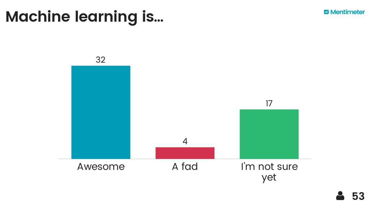
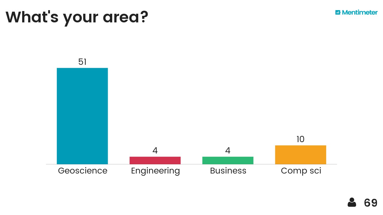
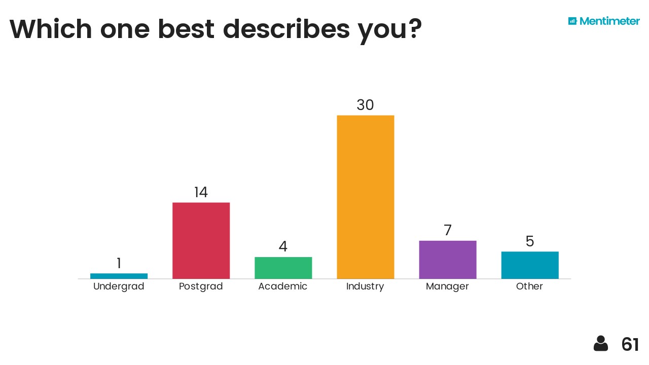
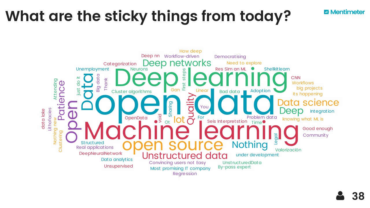
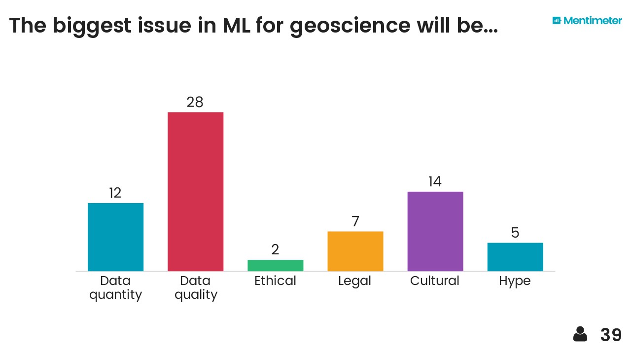
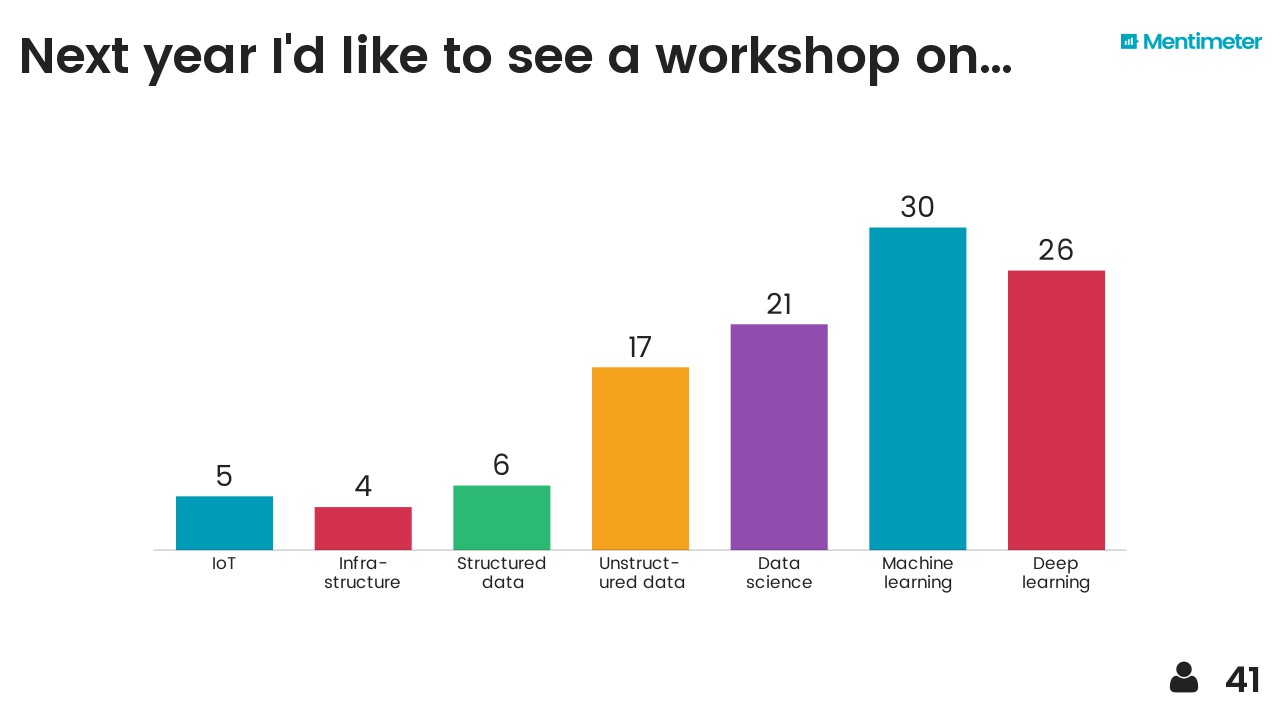
After hearing about Mentimeter from Chris Jackson I took the opportunity to try it out on the audience. Here are the results, I think they are fairly self-explanatory... 

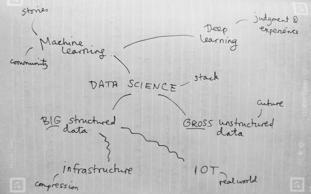
I also threw in the mindmap I drew at the end as a sort of summary. The vertical axis represents something like'abstraction' or 'time' (in a workflow sense) and I think each layer depends somewhat on those beneath it. It probably makes sense to no-one but me.

Breakout!

It seems clear that 2017 is the breakout year for machine learning in petroleum geoscience, and in petroleum in general. If your company or institution has not yet gone beyond "watching" or "thinking about" data science and machine learning, then it is falling behind by a little more every day, and it has been for at least a year. Now's the time to choose if you want to be part of what happens next, or a victim of it.

Le grand hack!

It happened! The Subsurface Hackathon drew to a magnificent close on Sunday, in an intoxicating cloud of code, creativity, coffee, and collaboration. It will take some beating.

Nine months in gestation, the hackathon was on a scale we have not attempted before. Total E&P joined us as co-organizers and made this new reach possible. They also let us use their amazing Booster — a sort of intrapreneurship centre — which was perfect for the event. Their team (thanks especially to Marine and Caroline!) did an amazing job of hosting, as well as providing several professionals from their subsurface software (thanks Jonathan and Yannick!) and data science teams (thanks Victor and David!). Arnaud Rodde and Frédéric Broust, who had to do some organization hacking of their own to make something as weird as a hackathon happen, should be proud of their teams.

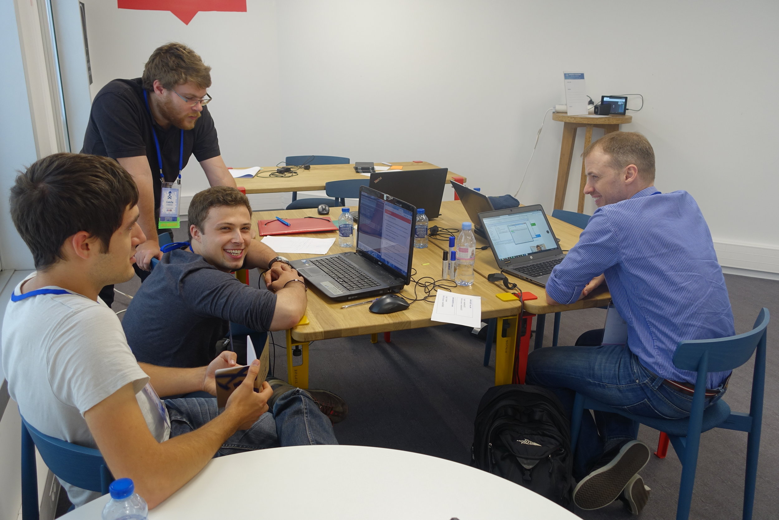
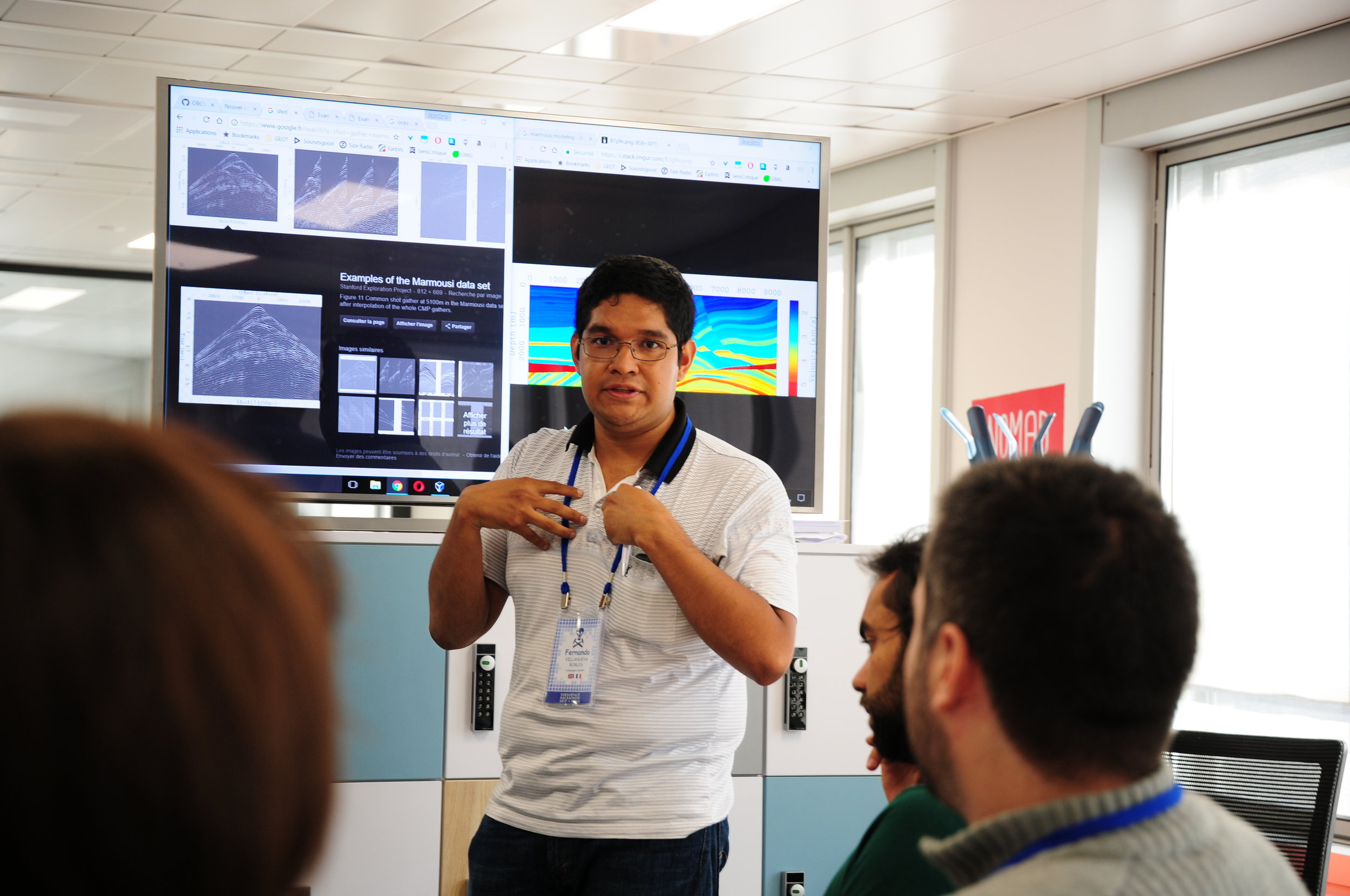
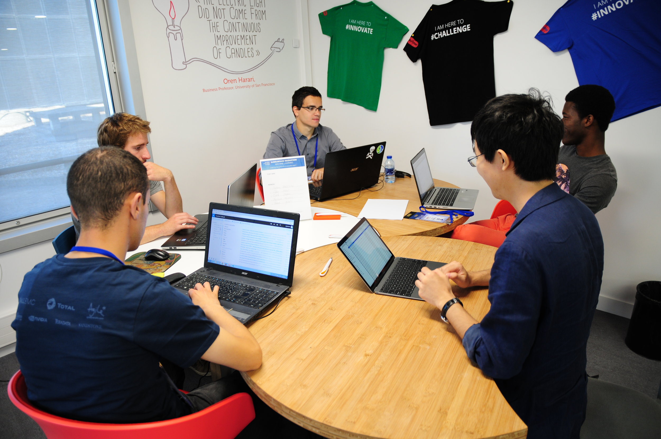
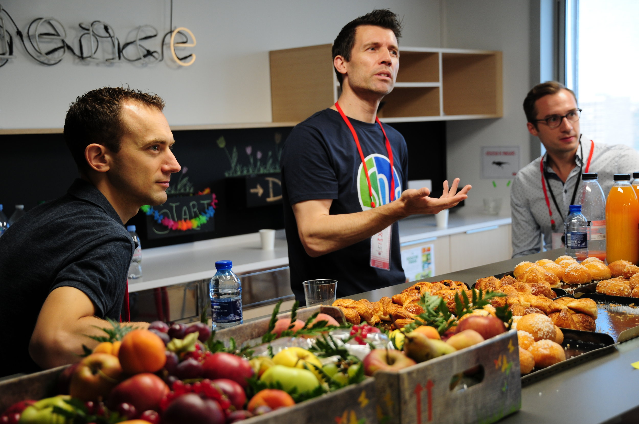
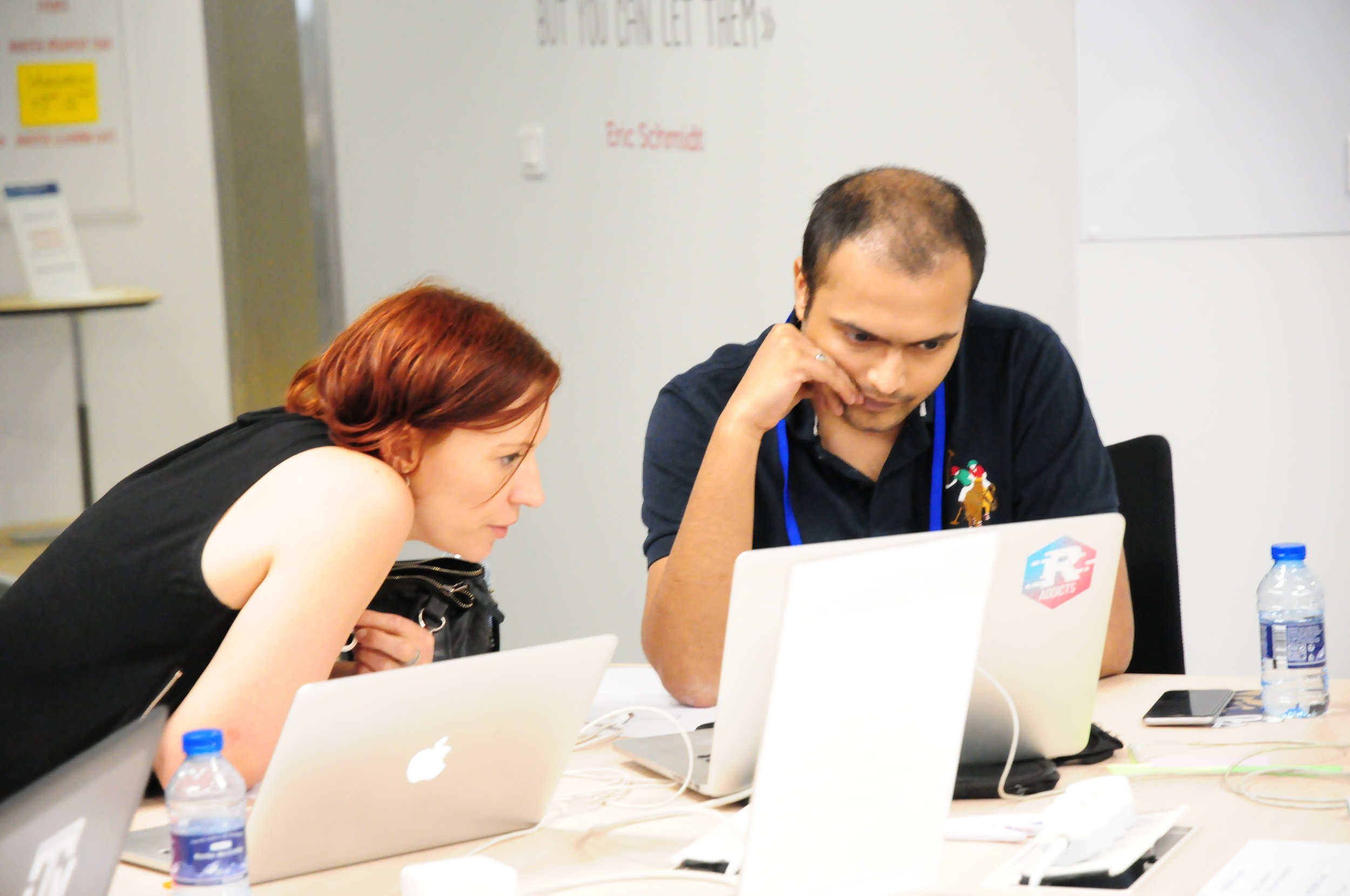
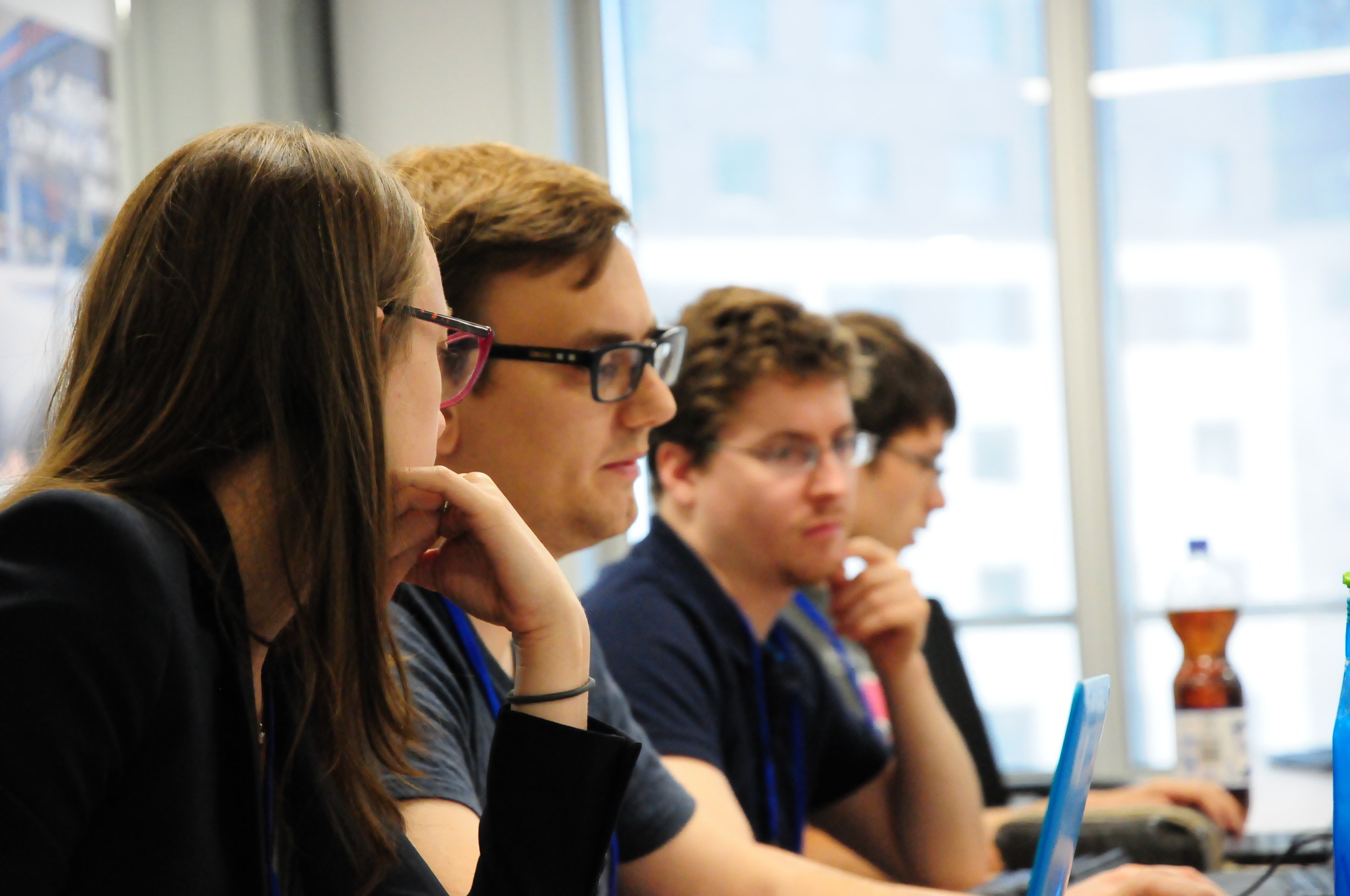
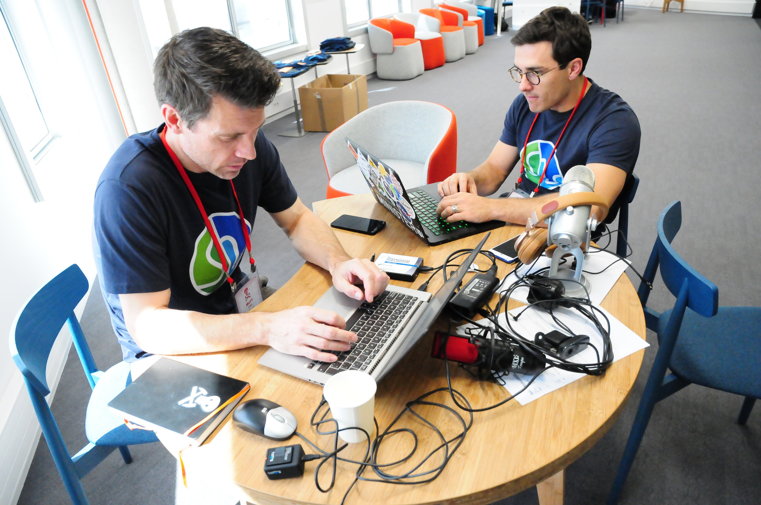
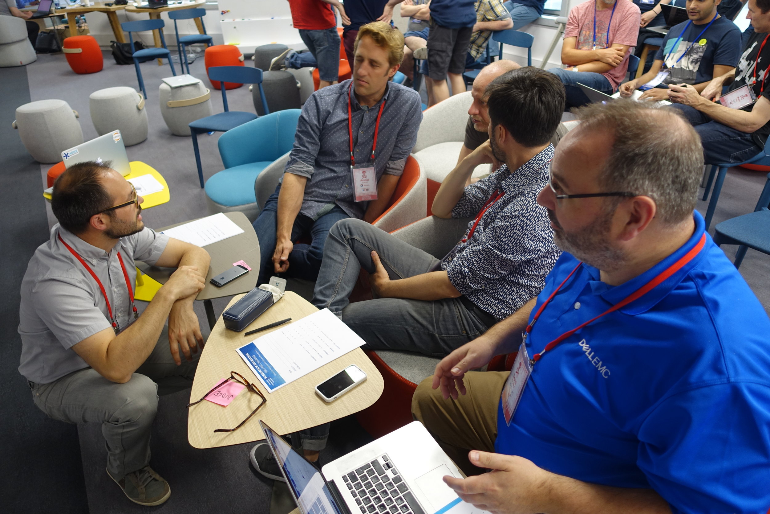
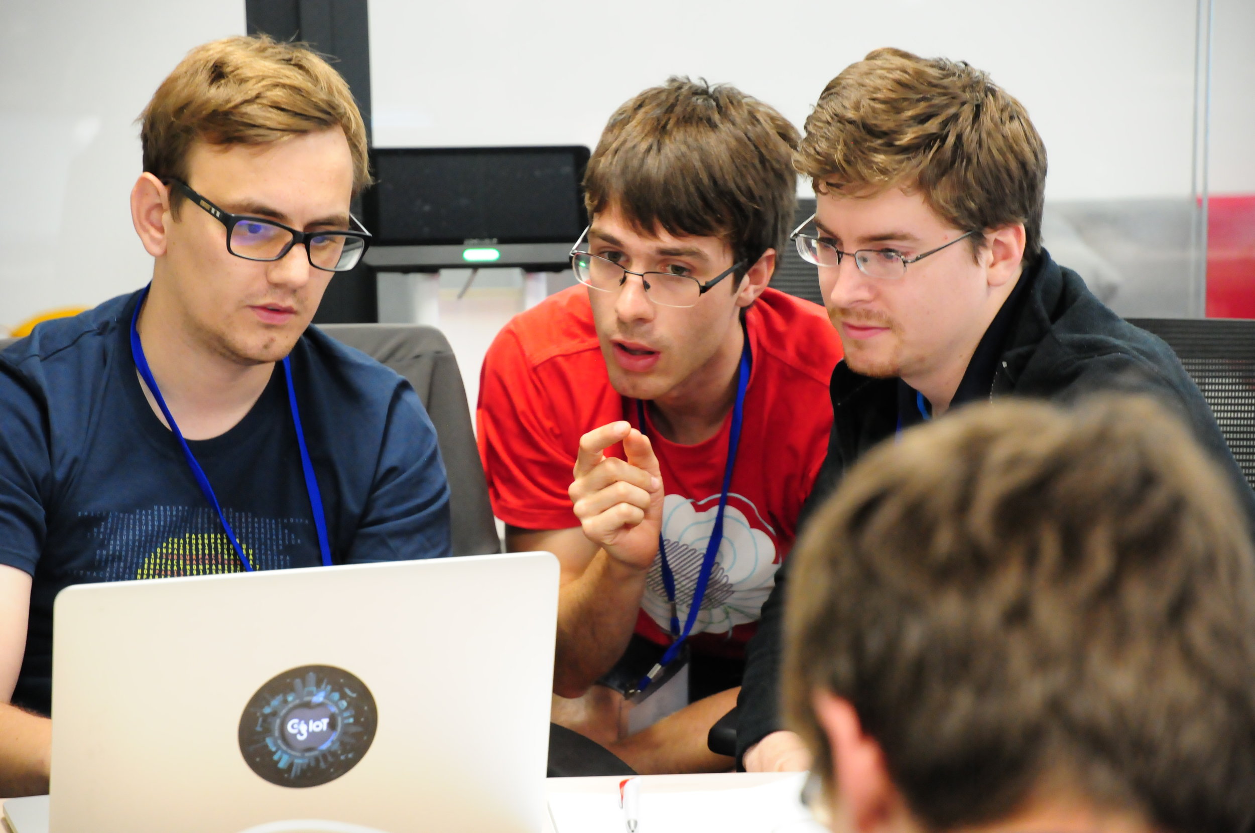
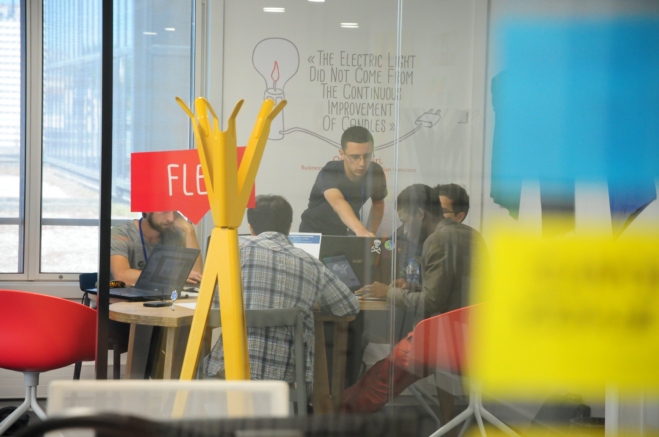
Instead of trying to describe the indescribable, here are some photos:

BY THE NUMBERS

16 hours of code
13 teams
62 hackers
44 students
4 robots
568 croissants
0 lost-time incidents

I won't say much about the projects for now. The diversity was high — there were projects in thin section photography, 3D geological modeling, document processing, well log prediction, seismic modeling and inversion, and fault detection. All of the projects included some kind of machine learning, and again there was diversity there, including several deep learning applications. Neural networks are back!

Feel the buzz!

If you are curious, Gram and I recorded a quick podcast and interviewed a few of the teams:

It's going to take a few days to decompress and come down from the high. In a couple of weeks I'll tell you more about the projects themselves, and we'll edit the photos and post the best ones to Flickr (and in the meantime there are a few more pics there already). 

Thank you to the sponsors!

Last thing: we couldn't have done any of this without the support of Dell EMC. David Holmes has been a rock for the hackathon project over the last couple of years, and we appreciate his love of community and code! Thank you too to Duncan and Jane at Teradata, Francois at NVIDIA, Peter and Jon at Amazon AWS, and Gram at Sandstone for all your support. Dear reader: please support these organizations!


Looking forward to EAGE

Evan, Diego and I are flying to Paris today for the EAGE Conference and Exhibition. It's exciting. We're excited. 

But the excitement starts before the conference. The Subsurface Hackathon is this weekend!

My diary

Even the hackathon excitement starts before the weekend, because tomorrow, Friday, we're running the hacker's bootcamp — a sort of short course appetizer for the hackathon. We have about 25 geoscientists coming to the Booster TOTAL (an event space at TOTAL's La Défense offices) to get some hands-on practice with Python and the latest in machine learning tools. It's especially exciting because we'll also have engineers from NVIDIA on hand to help with the coaching. The idea is to help people hit the ground running when the hackathon starts on Saturday.

After that, on Saturday and Sunday,  it's the hackathon itself. We have no fewer than 60 geoscientists and engineers registered for this breakout event. They're coming to the Booster to work on a wide array of machine learning ideas for the subsurface. It's going to be epic. You can read all about what happens next week, I promise. 

Then on Monday it's the Data Science for Geoscience workshop, at which I'm giving a keynote. Since I'm far from possessing expertise, I'm using it as a chance to get people jazzed about helping make the coming AI revolution in geoscience a positive experience. I'm really looking forward to it.

The conference itself starts on Tuesday. In the afternoon I'm co-chairing a session on machine learning (have you spotted the theme yet?) in seismic interpretation, along with Victor Aare of Schlumberger. It will be awesome to see what kind of progress our community is making in this field — it's fun to imagine what seismic interpretation might be like in a few years. There are so many fascinating problems to work on! Here are the talks in that session:

On Wednesday we'll be taking in some more talks and posters, then in the afternoon I'm reprising my keynote talk at IFPEN, a subsurface research institute in the Bois de Boulogne. I've never been there before, although I have met a few IFP scientists before. I'm looking forward to it very much. 

It all ends for us on Thursday. Evan and Diego fly home and I'm off to Cambridge (the old one in the fens, not the one in Massachusetts) for a few days with family (and bookshops). Until then, expect much blogging!


Going to EAGE?

If you're reading this and would like to meet up with us at Agile or some of the Software Underground crowd — the friendliest bunch of coding geoscientists you could hope for — let's plan to meet at the end of the workshop, at the workshop location. Look for the Software Underground shirts.

What should national data repositories do?

Right now there's a conference happening in Stavanger, Norway: National Data Repository 2017. My friend David Holmes of Dell EMC, a long time supporter of Agile's recent hackathons and general geocomputing infrastructure superhero, is there. He's giving a talk, I think, and chairing at least one session. He asked a question today on Software Underground:

If anyone has any thoughts or ideas as to what the regulators should be doing differently now is a good time to speak up :)

My response

For me it's about raising their aspirations. Collectively, they are sitting on one of the most valuable — or invaluable — datasets in the world, comparable to Hubble, or the LHC. Better yet, the data are (in most cases) already open and they actually want to share it. And the community (us) is better tooled than ever, and perhaps also more motivated, to get cracking. So the possibility is there to see a revolution in subsurface science and exploration (in the broadest sense of the word) and my challenge to them is:

Can they now create the conditions for this revolution in earth science?

Some things I think they can do right now:

  • Properly fund the development of an open data platform. I'll expand on this topic below.
  • Don't get too twisted off on formats (go primitive), platforms (pick one), licenses (go generic), and other busy work that committees love to fret over. Articulate some principles (e.g. public first, open source, small footprint, no lock-in, componentize, no single provider, let-users-choose, or what have you), and stay agile. 
  • Lobby NOCs and IOCs hard to embrace integrated and high-quality open data as an advantage that society, as well as industry, can share in. It's an important piece in the challenge we face to modernize the industry. Not so that it can survive for survival's sake, but so that it can serve society for as long as it's needed. 
  • Get involved in the community: open up their processes and collaborate a lot more with the technical societies — like show up and talk about their programs. (How did I not hear about the CDA's unstructured data challenge — a subject I'm very much into — till it was over? How many other potential participants just didn't know about it?)

An open data platform

The key piece here is the open data platform. Here are the features I'd like to see of such a platform:

  • Optimized for users, not the data provider, hosting provider, or system administrator.
  • Clear rights: well-known, documented, obvious, clearly expressed open licenses for re-use.
  • Meaningful levels of access that are free of charge for most users and most use cases.
  • Access for humans (a nice mappy web interface) with no awkward or slow registration processes.
  • Access for machines (a nice API, perhaps even a couple of libraries expressing it).
  • Tools for query, discovery, and retrieval; ideally with user feedback paths ('more like this, less like that').
  • Ways to report, or even fix, problems in the data. This relieves you of "the data's not ready" procrastination.
  • Good documentation of all of this, ideally in a wiki or something that people can improve.
  • Support for a community of users and developers that want to do things with the data.

Building this platform is not trivial. There is massive file storage, database back end, web front end, licensing, and so on. Then there's the community of developers and users to engage and support. It will take years, and never be finished. It sounds hard... but people are doing it. Prototypes for seismic data exist already, and there are countless models in other verticals (just check out the Registry of Research Data Repositories, or look at the list on PLOS). 

The contract to build data infrostructure is often awarded to the likes of Schlumberger, Halliburton or CGG. In theory, these companies have the engineering depth to pull them off (though this too is debatable, especially in today's web-first, native-never world). But they completely lack the culture required: there's no corporate understanding of what 'open' means. So the model is broken in subtle but fatal ways and the whole experiment fails. 

I'm excited to hear what comes out of this conference. If you're there, please tell!

Conversation not discussion

It's a while since we had a 'conferences are broken' rant on the Agile blog!

Five or six of the sessions at this year's conference were... different. I already mentioned the Value In Geophysics session, which was a cross between a regular series of talks and a panel discussion. I went to another, The modern geoscientist, which was structured the same way. A third one, Fundamentals of Professional Career Branding, was a mini workshop with Jackie Rafter of Higher Landing. There were at least a couple of other such sessions.

It's awesome to see the societies experimenting with something outside the usual plethora of talks and posters. I hope they were well received, because we need more of this in our discipline, now more than ever. If you went to one and enjoyed it, please let the organizers know.

But... the sessions — especially the panel discussion sessions — lacked something. One thing really:

The sessions we saw were nowhere near participatory enough. Not even close.

The 'expert-panel-enlightens-audience' pattern is slowing us down, perpetuating broken models of leadership and hierarchy. There isn't an expert in Calgary or the universe that knows how or when this downturn is going to end, or what we need to do to improve our chances of continuing to contribute to society and make a living in our profession. So please, stop throwing people up on a stage, making them give 5 minute presentations, and occasionally asking for questions from the audience. That is nothing like a discussion. Tune in to a political debate show to see what those look like: rapid-fire, punchy, controversial. In short: interesting. And, from an organizer's point of view, really hard, which is why we should stop.

Real conversation

What I think is really needed right now, more than half-baked expert discussion, is conversation. Conversations happen between small groups of people, all sitting on the same plane, around a table, with napkins to draw on and time to draw on them. They connect people and spread awesome ideas like viruses. What's more, great conversations have outcomes.

I don't want to claim that Agile has all this figured out, but we have demonstrated various ways of connecting scientists in meaningful ways and with lasting outcomes. We've also written extensively on the subject (e.g. here and here and here and here). Other verticals have conducted many more experiments, and documented the results. Humans know how to do this.

So there's no excuse — it's not too dramatic to call the current 'situation' a crisis in our profession in Canada — so we need to get beyond tinkering at the edges and half-hearted attempts at change. Our societies need to pay attention to what's needed, and get on with making it happen.

Still more ranting...

We talked about this topic at some length on the Undersampled Radio podcast yesterday. Here's the uncut video version:

Unweaving the rainbow

Last week at the Canada GeoConvention in Calgary I gave a slightly silly talk on colourmaps with Matteo Niccoli. It was the longest, funnest, and least fruitful piece of research I think I've ever embarked upon. And that's saying something.

Freeing data from figures

It all started at the Unsession we ran at the GeoConvention in 2013. We asked a roomful of geoscientists, 'What are the biggest unsolved problems in petroleum geoscience?'. The list we generated was topped by Free the data, and that one topic alone has inspired several projects, including this one. 

Our goal: recover digital data from any pseudocoloured scientific image, without prior knowledge of the colourmap.

I subsequently proferred this challenge at the 2015 Geophysics Hackathon in New Orleans, and a team from Colorado School of Mines took it on. Their first step was to plot a pseudocoloured image in (red, green blue) space, which reveals the colourmap and brings you tantalizingly close to retrieving the data. Or so it seems...

Here's our talk:

The new reality

In Calgary last week I heard the phrase "when the industry recovers" several times. Dean Potter even went so far as to say:

Don’t believe anyone who says ‘It’s different this time’. It isn’t.

He knows what he's talking about — the guy sold his company to Vermillion in 2014 for $427 million.

But I think he's dead wrong.

What's different this time?

A complete, or at least non-glacially-slow, recovery seems profoundly unlikely to me. We might possibly be through the 'everything burns to the ground' phase, but the frenzy of mergers and takeovers has barely started. That will take at least a couple of years. If and when any stability returns to operations, it seems highly probable that it will have these features:

  1. It will be focused on shale. (Look at the Permian Basin today.)
  2. It will need fewer geoscientists. (There are fewer geological risks.)
  3. It will be driven by data. (We have barely started on this.)
  4. It will end in another crash. (Hungry animals bolt their food.)

If you're a geoscientist and have never worked find-grained plays, I think the opportunities in front of you are going to be different from the ones you're used to. And by 'different', I mean 'scarcer'.

Where else can you look?

It may be time to think about a pivot, if you haven't already. (Pivot is lean-startup jargon for 'plan B' (or C). And I don't think it's a bad idea to think of yourself, or any business, as a start-up. Indeed, if you don't, you're headed for obsolescence.)

What would you pivot to? What's your plan B? If you think of petroleum geoscience as having a position in a matrix, think about our neighbours in that matrix. Industries are vertical; disciplines are horizontal.

Opportunities in neighbouring cells are probably within relatively easy reach. Think about:

  • Near surface: archaeology, UXO detection, engineering geophysics.
  • Geomatics, remote sensing, and geospatial analysis. Perhaps in mining or geothermal energy.
  • Stepping out of industry into education or government. People with applied knowledge have a lot to offer.
  • Making contacts in a new industry like finance or medicine. Tip: go to a conference. Talk to everyone you can find.

Think about your technical skills more broadly

I don't know where those new opportunities will come from, but I think it only takes a small shift in perspective to spot them. Think of your purpose, not your tasks. For example:

  • Many geophysicists are great quantitative scientists. If you know linear algebra or geostatistics and write code too, you have much sought-after skills in any industry.
  • Many geologists are great at spatial analysis. If you can wield geodatabases and GIS software like a wizard, you are a valuable asset to any industry.
  • Many engineers are great at project management and analytics. If you have broken out of Excel and can drive Spotfire or Tableau, you are gold in any industry.

If you forgot to keep your skills up to date and are locked into clicking buttons in Petrel, or making PowerPoint maps of the Cardium, or fiddling with charts in Excel, I'm not sure what to tell you. Everyone has those skills. You're yesterday's geoscientist and you don't have a second to lose. 

GeoConvention highlights

We were in Calgary last week at the Canada GeoConvention 2017. The quality of the talks seemed more variable than usual but, as usual, there were some gems in there too. Here are our highlights from the technical talks...

Filling in gaps

Mauricio Sacchi (University of Alberta) outlined a new reconstruction method for vector field data. In other words, filling in gaps in multi-compononent seismic records. I've got a soft spot for Mauricio's relaxed speaking style and the simplicity with which he presents linear algebra, but there are two other reasons that make this talk worthy of a shout out:

  1. He didn't just show equations in his talk, he used pseudocode to show the algorithm.
  2. He linked to his lab's seismic processing toolkit, SeismicJulia, on GitHub.

I am sure he'd be the first to admit that it is early days for for this library and it is very much under construction. But what isn't? All the more reason to showcase it openly. We all need a lot more of that.

Update on 2017-06-7 13:45 by Evan Bianco: Mauricio, has posted the slides from his talk

Learning about errors

Anton Birukov (University of Calgary & graduate intern at Nexen) gave a great talk in the induced seismicity session. It was a lovely mashing-together of three of our favourite topics: seismology, machine-learning, and uncertainty. Anton is researching how to improve microseismic and earthquake event detection by framing it as a machine-learning classification problem. He's using Monte Carlo methods to compute myriad synthetic seismic events by making small velocity variations, and then using those synthetic events to teach a model how to be more accurate about locating earthquakes.

Figure 2 from Anton Biryukov's abstract. An illustration of the signal classification concept. The signals originating from the locations on the grid (a) are then transformed into a feature space and labeled by the class containing the event or…

Figure 2 from Anton Biryukov's abstract. An illustration of the signal classification concept. The signals originating from the locations on the grid (a) are then transformed into a feature space and labeled by the class containing the event origin. From Biryukov (2017). Event origin depth uncertainty - estimation and mitigation using waveform similarity. Canada GeoConvention, May 2017.

The bright lights of geothermal energy
Matt Hall

Two interesting sessions clashed on Wednesday afternoon. I started off in the Value of Geophysics panel discussion, but left after James Lamb's report from the mysterious Chief Geophysicists' Forum. I had long wondered what went on in that secretive organization; it turns out they mostly worry about how to make important people like your CEO think geophysics is awesome. But the large room was a little dark, and — in keeping with the conference in general — so was the mood.

Feeling a little down, I went along to the Diversification of the Energy Industry session instead. The contrast was abrupt and profound. The bright room was totally packed with a conspicuously young audience numbering well over 100. The mood was hopeful, exuberant even. People were laughing, but not wistfully or ironically. I think I saw a rainbow over the stage.

If you missed this uplifting session but are interested in contributing to Canada's geothermal energy scene, which will certainly need geoscientists and reservoir engineers if it's going to get anywhere, there are plenty of ways to find out more or get involved. Start at cangea.ca and follow your nose.

We'll be writing more about the geothermal scene — and some of the other themes in this post — so stay tuned. 


DID YOU KNOW?

You can get regular updates right to your email, just drop your address in the box:

The fine print: No spam, we promise! We never share email addresses with 3rd parties. Unsubscribe any time with the link in the emails. The service is provided by MailChimp in accordance with Canada's anti-spam regulations.