
Shales and technology
/ Day three of the SEG IQ Earth Forum had more organizational diversity than the previous two days. The morning session was on seismic for unconventional plays. This afternoon was for showcasing novel implementations of seismic attributes.
Resource shale plays aren’t as wildly economic as people think. This is not only because geology is complex and heterogeneous, but also because drilling and completions processes aren't constant either. Robin Pearson from Anadarko presented a wonderful shale gas science experiment: three systematic field tests designed to target key uncertainties:
- List all of your uncertainties and come up with a single test for evaluating each, holding all other variables constant.
- Make sure you collect enough data so that results are statistically valid.
- Make your experiment scalable — 10 measurements must be extrapolatable to influence hundreds.
To better understand production heterogeniety, they drilled and fracked three wells in exactly the same way. Logging and microseismic surface monitoring showed a tight limestone zone that was liberating gas from a strike slip fault, previously unseen.
The best talk for interpreters so far was from Randy Pepper, who has done basin-scale modeling to define the erosional and non-depositional periods of geologic history not captured in the rock record. He used Wheeler diagrams to transform between two different representations of the same data, so that interpreters could work interactively between the structural and stratigraphic domains. It reminded me of dGB's Horizon Cube technology, allowing interpreters to explore between the mappable horizons in their data. Next step: allowing interpreters to perturb structural restorations on the fly.
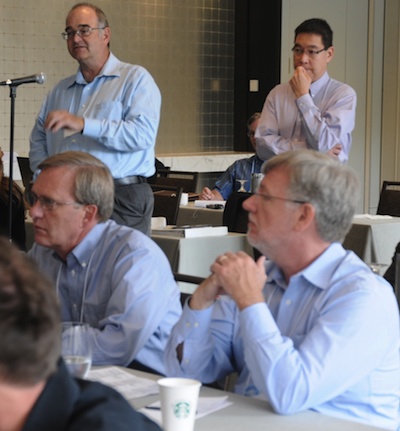
 If you showed a seismic amplitude map to a radiologist, they might form completely rational arguments for arteries and other anatomical structures. Interpreters sometimes see what they want to see, which can be a problem. My favorite talk so far was from Jonathan Henderson from ffa. He is dedicated to keeping art and expertise in the interpretation process. His company has developed software for building data-guided geobodies with an organic and intuitive design. Automatic data classification can only go so far in elucidating what the human brain can perceive. Read his article.
I repeat his principles here:
- Understanding the imaged geology: the art of interpretation,
- Measurements and Uncertainty: a need for science
- Adaptive Geobodies: combining art and science.
Kudos to John for ending the talk with a video demo of the software in action. Gasps from the crowd were a plenty. I'm hoping for more of this tomorrow!


 Except where noted, this content is licensed