Weekend worship in Salt Lake City

The Salt Lake City hackathon — only the second we've done with a strong geology theme — is a thing of history, but you can still access the event page to check out who showed up and who did what. (This events page is a new thing we launched in time for this hackathon; it will serve as a public document of what happens at our events, in addition to being a platform for people to register, sponsor, and connect around our events.) 

In true seat-of-the-pants hackathon style we managed to set up an array of webcams and microphones to record the finale. The demos are the icing on the cake. Teams were selected at random and were given 4 minutes to wow the crowd. Here is the video, followed by a summary of what each team got up to... 


Unconformist.ai

Didi Ooi (University of Bristol), Karin Maria Eres Guardia (Shell), Alana Finlayson (UK OGA), Zoe Zhang (Chevron). The team used machine learning the automate the mapping of unconformities in subsurface data. One of the trickiest parts is building up a catalog of data-model pairs for GANs to train on. Instead of relying on thousand or hundreds of thousands of human-made seismic interpretations, the team generated training images by programmatically labelling pixels on synthetic data as being either above (white) or below (black) the unconformity. Project pageSlides.

unconformist.ai_preso

Outcrops Gee Whiz

Thomas Martin (soon Colorado School of Mines), Zane Jobe (Colorado School of Mines), Fabien Laugier (Chevron), and Ross Meyer (Colorado School of Mines). The team wrote some programs to evaluate facies variability along drone-derived digital outcrop models. They did this by processing UAV point cloud data in Python and classified different rock facies using using weather profiles, local cliff face morphology, and rock colour variations as attributes. This research will help in the development drone assisted 3D scanning to automate facies boundaries mapping and rock characterization. RepoSlides.

SLC_outcrop_geewhiz_blog.png

Jet Loggers

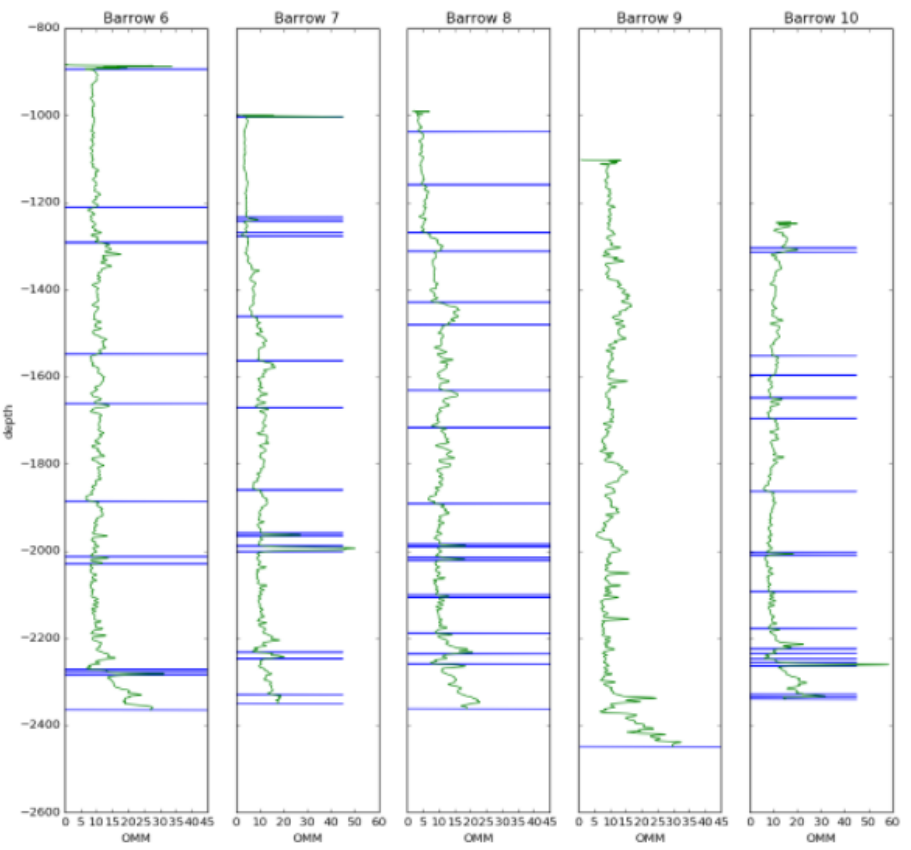
Eirik Larsen and Dimitrios Oikonomou (Earth Science Analytics), and Steve Purves (Euclidity). This team of European geoscientists, with their circadian clocks all out of whack, investigated if a language of stratigraphy can be extracted from the rock record and, if so, if it can be used as another tool for classifying rocks. They applied natural language processing (NLP) to an alphabetic encoding of well logs as a means to assist or augment the labour-intensive tasks of classifying stratigraphic units and picking tops. Slides.


SLC_NLP_jet_loggers.png
SLC_bookcliffs.png

Book Cliffs Bandits

Tom Creech (ExxonMobil) and Jesse Pisel (Wyoming State Geological Survey). The team started munging datasets in the Book Cliffs. Unfortunately, they really did not have the perfect, ready to go data, and by the time they pivoted to some workable open data from Alaska, their team name had already became a thing. The goal was build a tool to assist with lithology and stratigraphic correlation. They settled on change-point detection using Bayesian statistics, which they were using to build richer feature sets to test if it could produce more robust automatic stratigraphic interpretation. Repo, and presentation.


A channel runs through it

Nam Pham (UT Austin), Graham Brew (Dynamic Graphics), Nathan Suurmeyer (Shell). Because morphologically realistic 3D synthetic seismic data is scarce, this team wrote a Python program that can take seismic horizon interpretations from real data, then construct richer training data sets for building an AI that can automatically delineate geological entities in the subsurface. The pixels enclosed by any two horizons are labelled with ones, pixels outside this region are labelled with zeros. This work was in support of Nam's thesis research which is using the SegNet architecture, and aims to extract not only major channel boundaries in seismic data, but also the internal channel structure and variability – details that many seismic interpreters, armed even with state-of-the art attribute toolboxes, would be unable to resolve. Project page, and code.

GeoHacker

Malcolm Gall (UK OGA), Brendon Hall and Ben Lasscock (Enthought). Innovation happens when hackers have the ability to try things... but they also need data to try things out on. There is a massive shortage of geoscience datasets that have been staged and curated for machine learning research. Team Geohacker's project wasn't a project per se, but a platform aimed at the sharing, distribution, and long-term stewardship of geoscience data benchmarks. The subsurface realm is swimming with disparate data types across a dizzying range of length scales, and indeed community efforts may be the only way to prove machine-learning's usefulness and keep the hype in check. A place where we can take geoscience data, and put it online in a ready-to-use for for machine learning. It's not only about being open, online and accessible. Good datasets, like good software, need to be hosted by individuals, properly documented, enriched with tutorials and getting-started guides, not to mention properly funded. Website.

SLC_petrodict.png

Petrodict

Mark Mlella (Univ. Louisiana, Lafayette), Matthew Bauer (Anchutz Exploration), Charley Le (Shell), Thomas Nguyen (Devon). Petrodict is a machine-learning driven, cloud-based lithology prediction tool that takes petrophysics measurements (well logs) and gives back lithology. Users upload a triple combo log to the app, and the app returns that same log with with volumetric fractions for it's various lithologic or mineralogical constituents. For training, the team selected several dozen wells that had elemental capture spectroscopy (ECS) logs – a premium tool that is run only in a small fraction of wells – as well as triple combo measurements to build a model for predicting lithology. Repo.

Seismizor

George Hinkel, Vivek Patel, and Alex Waumann (all from University of Texas at Arlington). Earthquakes are hard. This team of computer science undergraduate students drove in from Texas to spend their weekend with all the other geo-enthusiasts. What problem in subsurface oil and gas did they identify as being important, interesting, and worthy of their relatively unvested attention? They took on the problem of induced seismicity. To test whether machine learning and analytics can be used to predict the likelihood that injected waste water from fracking will cause an earthquake like the ones that have been making news in Oklahoma. The majority of this team's time was spent doing what all good scientists do –understanding the physical system they were trying to investigate – unabashedly pulling a number of the more geomechanically inclined hackers from neighbouring teams and peppering them with questions. Induced seismicity is indeed a complex phenomenon, but George's realization that, "we massively overestimated the availability of data", struck a chord, I think, with the judges and the audience. Another systemic problem. The dynamic earth – incredible in its complexity and forces – coupled with the fascinating and politically charged technologies we use for drilling and fracking might be one of the hardest problems for machine learning to attack in the subsurface. 


AAPG next year is in San Antonio. If it runs, the hackathon will be 18–19 of May. Mark your calendar and stay tuned!

Unweaving the rainbow

Last week at the Canada GeoConvention in Calgary I gave a slightly silly talk on colourmaps with Matteo Niccoli. It was the longest, funnest, and least fruitful piece of research I think I've ever embarked upon. And that's saying something.

Freeing data from figures

It all started at the Unsession we ran at the GeoConvention in 2013. We asked a roomful of geoscientists, 'What are the biggest unsolved problems in petroleum geoscience?'. The list we generated was topped by Free the data, and that one topic alone has inspired several projects, including this one. 

Our goal: recover digital data from any pseudocoloured scientific image, without prior knowledge of the colourmap.

I subsequently proferred this challenge at the 2015 Geophysics Hackathon in New Orleans, and a team from Colorado School of Mines took it on. Their first step was to plot a pseudocoloured image in (red, green blue) space, which reveals the colourmap and brings you tantalizingly close to retrieving the data. Or so it seems...

Here's our talk:

Copyright and seismic data

Seismic company GSI has sued a lot of organizations recently for sharing its copyrighted seismic data, undermining its business. A recent court decision found that seismic data is indeed copyrightable, but Canadian petroleum regulations can override the copyright. This allows data to be disclosed by the regulator and copied by others — made public, effectively.


Seismic data is not like other data

Data is uncopyrightable. Like facts and ideas, data is considered objective, uncreative — too cold to copyright. But in an important ruling last month, the Honourable Madam Justice Eidsvik established at the Alberta Court of the Queen's Bench that seismic data is not like ordinary data. According to this ruling:


...the creation of field and processed [seismic] data requires the exercise of sufficient skill and judgment of the seismic crew and processors to satisfy the requirements of [copyrightability].


These requirements were established in the case of accounting firm CCH Canadian Limited vs The Law Society of Upper Canada (2004) in the Supreme Court of Canada. Quoting from that ruling:


What is required to attract copyright protection in the expression of an idea is an exercise of skill and judgment. By skill, I mean the use of one’s knowledge, developed aptitude or practised ability in producing the work. By judgment, I mean the use of one’s capacity for discernment or ability to form an opinion or evaluation by comparing different possible options in producing the work.


Interestingly:


There exist no cases expressly deciding whether Seismic Data is copyrightable under the American Copyright Act [in the US].


Fortunately, Justice Eidsvik added this remark to her ruling — just in case there was any doubt:


I agree that the rocks at the bottom of the sea are not copyrightable.

It's really worth reading through some of the ruling, especially sections 7 and 8, entitled Ideas and facts are not protected and Trivial and purely mechanical respectively. 

Why are we arguing about this?

This recent ruling about seismic data was the result of an action brought by Geophysical Service Incorporated against pretty much anyone they could accuse of infringing their rights in their offshore seismic data, by sharing it or copying it in some way. Specifically, the claim was that data they had been required to submit to regulators like the C-NLOPB and the C-NSOPB was improperly shared, undermining its business of shooting seismic data on spec.

You may not have heard of GSI, but the company has a rich history as a technical and business innovator. The company was the precursor to Texas Instruments, a huge player in the early development of computing hardware — seismic processing was the 'big data' of its time. GSI still owns the largest offshore seismic dataset in Canada. Recently, however, the company seems to have focused entirely on litigation.

The Calgary company brought more than 25 lawsuits in Alberta alone against corporations, petroleum boards, and others. There have been other actions in other jurisdictions. This ruling is just the latest one; here's the full list of defendants in this particular suit (there were only 25, but some were multiple entities):

  • Devon Canada Corporation
  • Statoil Canada Ltd.
  • Anadarko Petroleum Corporation
  • Anadarko US Offshore Corporation
  • NWest Energy Corp.
  • Shoal Point Energy Ltd.
  • Vulcan Minerals Inc.
  • Corridor Resources Inc.
  • CalWest Printing and Reproductions
  • Arcis Seismic Solutions Corp.
  • Exploration Geosciences (UK) Limited
  • Lynx Canada Information Systems Ltd.
  • Olympic Seismic Ltd.
  • Canadian Discovery Ltd.
  • Jebco Seismic UK Limited
  • Jebco Seismic (Canada) Company
  • Jebco Seismic, LP
  • Jebco/Sei Partnership LLC
  • Encana Corporation
  • ExxonMobil Canada Ltd.
  • Imperial Oil Limited
  • Plains Midstream Canada ULC
  • BP Canada Energy Group ULC
  • Total S.A.
  • Total E&P Canada Ltd.
  • Edison S.P.A.
  • Edison International S.P.A.
  • ConocoPhillips Canada Resources Corp.
  • Canadian Natural Resources Limited
  • MGM Energy Corp
  • Husky Oil Limited
  • Husky Oil Operations Limited
  • Nalcor Energy – Oil and Gas Inc.
  • Suncor Energy Inc.
  • Murphy Oil Company Ltd.
  • Devon ARL Corporation

Why did people share the data?

According to Section 101 Disclosure of Information of the Canada Petroleum Resources Act (1985) , geophysical data should be released to regulators — and thus, effectively, the public — five years after acquisition:


(2) Subject to this section, information or documentation is privileged if it is provided for the purposes of this Act [...]
(2.1) Subject to this section, information or documentation that is privileged under subsection 2 shall not knowingly be disclosed without the consent in writing of the person who provided it, except for the purposes of the administration or enforcement of this Act [...]

(7) Subsection 2 does not apply in respect of the following classes of information or documentation obtained as a result of carrying on a work or activity that is authorized under the Canada Oil and Gas Operations Act, namely, information or documentation in respect of

(d) geological work or geophysical work performed on or in relation to any frontier lands,
    (i) in the case of a well site seabed survey [...], or
    (ii) in any other case, after the expiration of five years following the date of completion of the work;


As far as I can tell, this does not necessarily happen, by the way. There seems to be a great deal of confusion in Canada about what 'seismic data' actually is — companies submit paper versions, sometimes with poor processing, or perhaps only every 10th line of a 3D. But the Canada Oil and Gas Geophysical Operations Regulations are quite clear. This is from the extensive and pretty explicit 'Final Report' requirements: 


(j) a fully processed, migrated seismic section for each seismic line recorded and, in the case of a 3-D survey, each line generated from the 3-D data set;


The intent is quite clear: the regulators are entitled to the stacked, migrated data. The full list is worth reading, it covers a large amount of data. If this is enforced, it is not very rigorous. If these datasets ever make it into the hands of the regulators, and I doubt it ever all does, then it's still subject to the haphazard data management practices that this industry has ubiquitously adopted.

GSI argued that 'disclosure', as set out in Section 101 of the Act, does not imply the right to copy, but the court was unmoved:


Nonetheless, I agree with the Defendants that [Section 101] read in its entirety does not make sense unless it is interpreted to mean that permission to disclose without consent after the expiry of the 5 year period [...] must include the ability to copy the information. In effect, permission to access and copy the information is part of the right to disclose.


So this is the heart of the matter: the seismic data was owned and copyrighted by GSI, but the regulations specify that seismic data must be submitted to regulators, and that they can disclose that data to others. There's obvious conflict between these ideas, so which one prevails? 

The decision

There is a principle in law called Generalia Specialibus Non Derogant. Quoting from another case involving GSI:


Where two provisions are in conflict and one of them deals specifically with the matter in question while the other is of more general application, the conflict may be avoided by applying the specific provision to the exclusion of the more general one. The specific prevails over the more general: it does not matter which was enacted first.


Quoting again from the recent ruling in GSI vs Encana et al.:


Parliament was aware of the commercial value of seismic data and attempted to take this into consideration in its legislative drafting. The considerations balanced in this regard are the same as those found in the Copyright Act, i.e. the rights of the creator versus the rights of the public to access data. To the extent that GSI feels that this policy is misplaced, its rights are political ones – it is not for this Court to change the intent of Parliament, unfair as it may be to GSI’s interests.


Finally:


[...the Regulatory Regime] is a complete answer to the suggestion that the Boards acted unlawfully in disclosing the information and documentation to the public. The Regulatory Regime is also a complete answer to whether the copying companies and organizations were entitled to receive and copy the information and documentation for customers. For the oil companies, it establishes that there is nothing unlawful about accessing or copying the information from the Boards [...]


So that's it: the data was copyright, but the regulations override the copyright, effectively. The regulations were legal, and — while GSI might find the result unfair — it must operate under them. 

The decision must be another step towards the end of this ugly matter. Maybe it's the end. I'm sure those (non-lawyers) involved can't wait for it to be over. I hope GSI finds a way back to its technical core and becomes a great company again. And I hope the regulators find ways to better live up to the fundamental idea behind releasing data in the first place: that the availability of the data to the public should promote better science and better decisions for Canada's offshore. As things stand today, the whole issue of 'public subsurface data' in Canada is, frankly, a mess.

New open data and a competition

First, a quick announcement. EMC, the data storage and cloud computing company, has stepped up to sponsor the Subsurface Hackathon in Vienna in a few weeks. Their generous help will ensure a fun event with some awesome prizes — so get signed up and start planning your project!


New open data

A correspondent got in touch last week about an exciting new open seismic dataset. In the late summer and early autumn of 2015, the WesternGeco-acquired a large new 2D seismic survey in the Rockall Basin and the Mid North Sea High for the UK Government. The survey cost about £20 million and consists of 20,000 km of new broadband PreSTM data. At the end of March, the dataset will be released to the public for free download, along with about 20,000 km of legacy 2D data, 40,000 km of new gravity and magnetic data, and wells.

© Crown Copyright — Used under fair use provision.

If you are interested in downloading the data, the government is asking that you fill out this form — it will help them figure out what to make available, and how much infrastructure to provision. Excitingly, they are asking about angle stacks, PSTM gathers, not just the full stack. It sounds like being an important resource for our community.

They are even asking about interest in the field data — all 60TB of it. There will almost certainly be a fee associated with the larger datasets, by the way. I asked about this and it sounds like it will likely be on the order of several thousand pounds to handle the full SEGD data, because of course it will be on physical media. But the government is open to suggestions if the geophysical community would like to find another way to distribute the data — do let me know if you'd like to talk about this.

New seed funding

Along with the data package, the government has announced an exciting new competition for 'seed funding':

The £500,000 competition has been designed to encourage geoscientists and engineers to develop innovative interpretations and products potentially using [this new open data]...

The motivation for the competition is clear:

It is hoped the competition will not only significantly increase the understanding of these frontier areas in respect of the 29th Seaward Licensing Round later in the year, but also retain talent in the oil and gas community which has been affected by the oil and gas industry downturn.

The parameters of the competition are spelled out in the Word document on this tender notice. It sounds like almost anything goes: data analysis, product development, even exploration activity. So get creative — and pitch the coolest thing you can think of!

You'll have to get cracking though, because applications to take part must be in by 1 April. If selected, the project must be delivered on 11 November.

The Rock Property Catalog again

Do you like data? Data about rocks? Open, accessible data that you can use for any purpose without asking? Read on.

After writing about anisotropy back in February, and then experimenting with storing rock properties in SubSurfWiki later that month, a few things happened:

  • The server I run the wiki on — legacy Amazon AWS infrastructure — crashed, and my backup strategy turned out to be <cough> flawed. It's now running on state-of-the-art Amazon servers. So my earlier efforts were mostly wiped out... Leaving the road clear for a new experiment!
  • I came across an amazing resource called Mudrock Anisotropy, or — more appealingly — Mr Anisotropy. Compiled by Steve Horne, it contains over 1000 records of rocks, gathered from the literature. It is also public domain and carries only a disclaimer. But it's a spreadsheet, and emailing a spreadsheet around is not sustainable.
  • The Common Ground database that was built by John A. Scales, Hans Ecke and Mike Batzle at Colorado School of Mines in the late 1990s, is now defunct and has been officially discontinued, as of about two weeks ago. It contains over 4000 records, and is public domain. The trouble is, you have to restore a SQLite database to use it.

All this was pointing towards a new experiment. I give you: the Rock Property Catalog again! This time it contains not 66 rocks, but 5095 rocks. Most of them have \(V_\mathrm{P}\), \(V_\mathrm{S}\) and  \(\rho\). Many of them have Thomsen's parameters too. Most have a lithology, and they all have a reference. Looking for Cretaceous shales in North America to use as analogs on your crossplots? There's a rock for that.

As before, you can query the catalog in various ways, either via the wiki or via the web API. Let's say we want to find shales with a velocity over 5000 m/s. You have a few options:

  1. Go to the semantic search form on the wiki and type [[lithology::shale]][[vp::>5000]]
  2. Make a so-called inline query on your own wiki page (you need an account for this).
  3. Make a query via the web API with a rather long URL: http://www.subsurfwiki.org/api.php?action=ask&query=[[RPC:%2B]][[lithology::shale]][[Vp::>5000]]|%3FVp|%3FVs|%3FRho&format=jsonfm

I updated the Jupyter Notebook I published last time with a new query. It's pretty hacky. I'll work on this to produce a more robust method, with some error handling and cleaner code — stay tuned.

The database supports lots of properties, including:

  • Citation and reference
  • Description, lithology, colour (you can have pictures if you want!)
  • Location, lat/lon, basin, age, depth
  • Vp, Vs, \(\rho\), as well as \(\rho_\mathrm{dry}\) and \(\rho_\mathrm{grain}\)
  • Thomsen's \(\epsilon\), \(\delta\), and \(\gamma\)
  • Static and dynamic Young's modulus and Poisson ratio
  • Confining pressure, pore pressure, effective stress, axial stress
  • Frequency
  • Fluid, saturation type, saturation
  • Porosity, permeability, temperature
  • Composition

There is more from the Common Ground data to add, especially photographs. But for now, I'd love some feedback: is this the right set of properties? Do we need more? I want this to be useful — what kind of data and metadata would you like to see? 

I'll end with the usual appeal — I'm open to any kind of suggestions or help with this. Perhaps you can contribute new rocks, or a paper containing data? Or maybe you have some wiki skills, or can help write bots to improve the data? What can you bring? 

Rock property catalog

RPC.png

One of the first things I do on a new play is to start building a Big Giant Spreadsheet. What goes in the big giant spreadsheet? Everything — XRD results, petrography, geochemistry, curve values, elastic parameters, core photo attributes (e.g. RGB triples), and so on. If you're working in the Athabasca or the Eagle Ford then one thing you have is heaps of wells. So the spreadsheet is Big. And Giant. 

But other people's spreadsheets are hard to use. There's no documentation, no references. And how to share them? Email just generates obsolete duplicates and data chaos. And while XLS files are not hard to put on the intranet or Internet,  it's hard to do it in a way that doesn't involve asking people to download the entire spreadsheet — duplicates again. So spreadsheets are not the best choice for collaboration or open science. But wikis might be...

The wiki as database

Regular readers will know that I'm a big fan of MediaWiki. One of the most interesting extensions for the software is Semantic MediaWiki (SMW), which essentially turns a wiki into a database — I've written about it before. Of course we can read any wiki page over the web, but you can query an SMW-powered wiki, which means you can, for example, ask for the elastic properties of a rock, such as this Mesaverde sandstone from Thomsen (1986). And the wiki will send you this JSON string:

{u'exists': True,
 u'fulltext': u'Mesaverde immature sandstone 3 (Kelly 1983)',
 u'fullurl': u'http://subsurfwiki.org/wiki/Mesaverde_immature_sandstone_3_(Kelly_1983)',
 u'namespace': 0,
 u'printouts': {
    u'Lithology': [{u'exists': True,
      u'fulltext': u'Sandstone',
      u'fullurl': u'http://www.subsurfwiki.org/wiki/Sandstone',
      u'namespace': 0}],
    u'Delta': [0.148],
    u'Epsilon': [0.091],
    u'Rho': [{u'unit': u'kg/m\xb3', u'value': 2460}],
    u'Vp': [{u'unit': u'm/s', u'value': 4349}],
    u'Vs': [{u'unit': u'm/s', u'value': 2571}]
  }
}

This might look horrendous at first, or even at last, but it's actually perfectly legible to Python. A little bit of data wrangling and we end up with data we can easily plot. It takes no more than a few lines of code to read the wiki's data, and construct this plot of \(V_\text{P}\) vs \(V_\text{S}\) for all the rocks I have so far put in the wiki — grouped by gross lithology:

A page from the Rock Property Catalog in Subsurfwiki.org. Very much an experiment, rocks contain only a few key properties today.

A page from the Rock Property Catalog in Subsurfwiki.org. Very much an experiment, rocks contain only a few key properties today.

If you're interested in seeing how to make these queries, have a look at this IPython Notebook. It takes you through reading the data from my embryonic catalogue on Subsurfwiki, processing the JSON response from the wiki, and making the plot. Once you see how easy it is, I hope you can imagine a day when people are publishing open data on the web, and sharing tools to query and visualize it.

Imagine it, then figure out how you can help build it!


References

Thomsen, L (1986). Weak elastic anisotropy. Geophysics 51 (10), 1954–1966. DOI 10.1190/1.1442051.

10 ways to improve your data store

When I look at the industry's struggle with the data mess, I see a parallel with science's struggle with open data. I've written lots about that before, but the basic idea is simple: scientists need discoverable, accessible, documented, usable data. Does that sound familiar?

I wrote yesterday that I think we have to get away from the idea that we can manage data like we might manage a production line. Instead, we need to think about more organic, flexible strategies that cope with and even thrive on chaos. I like, or liked until yesterday, the word 'curation', because it implies ongoing care and a focus on the future. But my friend Eric Marchand was right in his comment yesterday — the dusty connotation is too strong, and dust is bad for data. I like his supermarket analogy: packaged, categorized items, each with a cost of production and a price. A more lively, slightly chaotic market might match my vision better — multiple vendors maintaining their own realms. One can get carried away with analogies, but I like this better than a library or museum.

The good news is that lots of energetic and cunning people have been working on this idea of open data markets. So there are plenty of strategies we can try, alongside the current strategy of giving giant service companies millions of dollars for their TechCloud® Integrated ProSIGHT™ Data Management Solutions.

Serve your customer:

  • Above all else, build what people need. It's amazing that this needs to be said, but ask almost anyone what they think of IT at their company and you will know that it is not how it works today. Everything you build should be in response to the business pulling. 
  • This means you have to get out of the building and talk to your customers. In person, one-one-one. Watch them use your systems. Listen to them. Respond to them. 

Knock down the data walls:

  • Learn and implement open data practices inside the organization. Focus on discoverability, accessiblity, documentation of good-enough data, not on building The One True Database. 
  • Encourage and fund open data practices among providers of public data. There is a big role here for our technical societies, I believe, but I don't think they have seen it yet.

I've said it before: hire loads of geeks:

  • The web (well, intranet) is your pipeline. Build and maintain proper machine interfaces (APIs and web APIs) for data. What, you don't know how to do this? I know; it means hiring web-savvy data-obsessed programmers.
  • Bring back the hacker technologists that I think I remember from the nineties. Maybe it's a myth memory, but sprinkled around big companies there used to be super-geeks with degrees in astrophysics, mad UNIX skills, and the Oracle admin password. Now it's all data managers with Petroleum Technology certificates who couldn't write an awk script if your data depended on it (it does). 
  • Institute proper data wrangling and analysis training for scientists. I think this is pretty urgent. Anecdotal evidence: the top data integration tools in our business is PowerPoint... or an Excel chart with two y-axes if we're talking about engineers. (What does E&P mean?)

Three more things:

  • Let data live where it wants to live (databases, spreadsheets, wikis, SharePoint if you must). Focus on connecting data with APIs and data translators. It's pointless trying to move data to where you want it to be — you're just making it worse. ("Oh, you moved my spreadsheet? Fine, I will copy my spreadsheet.")
  • Get out of the company and find out what other people are doing. Not the other industry people struggling with data — they are just as clueless as we are. Find out what the people who are doing amazing things with data are doing: Google, Twitter, Facebook, data.gov, Wikipedia, Digital Science, The New York Times, The Guardian,... there are so many to choose from. We should invite these people to our conferences; they can help us.
  • If you only do one thing, fix search in your company. Stop tinkering with semantic ontologies and smart catalogs, just buy Google Search Appliance and fix it. You can get this one done by Christmas.

Last thing. If there's one mindset that will really get in the way, it's the project mindset. If we want to go beyond coping with the data mess, far beyond it to thriving on it, then we have to get comfortable with the idea that this is not a project. The word is banned, along with 'initiative', 'governance', and Gantt charts. The requirements you write on the back of a napkin with three colleagues will be just as useful as the ones you get back from three months of focus groups.

No, this is the rest of your career. This is never done, next year there are better ideas, more flexible libraries, faster hardware, and new needs. It's like getting fit: this ain't an 8-week get-fit program, it's an eternity of crunches.

The photograph of Covent Market in London, Ontario is from Boris Kasimov on Flickr.

Data management fairy tales

On Tuesday I read this refreshing post in LinkedIn by Jeffrey Maskell of Westheimer Energy Consultants. It's a pretty damning assessment of the current state of data management in the petroleum industry:

The fact is that no major technology advances have been seen in the DM sector for some 20 years. The [data management] gap between acquisition and processing/interpretation is now a void and is impacting the industry across the board...

I agree with him. But I don't think he goes far enough on the subject of what we should do about it. Maskell is, I believe, advocating more effort (and more budget) developing what the data management crowd have been pushing for years. In a nutshell:

I agree that standards, process, procedures, workflows, data models are all important; I also agree that DM certification is a long term desirable outcome. 

These words make me sad. I'd go so far as to say that it's the pursuit of these mythical ideas that's brought about today's pitiful scene. If you need proof, just look around you. Go look at your shared drive. Go ask someone for a well file. Go and (a) find then (b) read your IT policies and workflow documents — they're all fairy tales.

Maskell acknowledges at least that these are not enough; he goes on:

However I believe the KEY to achieving a breakthrough is to prove positively that data management can make a difference and that the cost of good quality data management is but a very small price to pay...

No, the key to achieving a breakthrough is a change of plan. Another value of information study just adds to the misery.

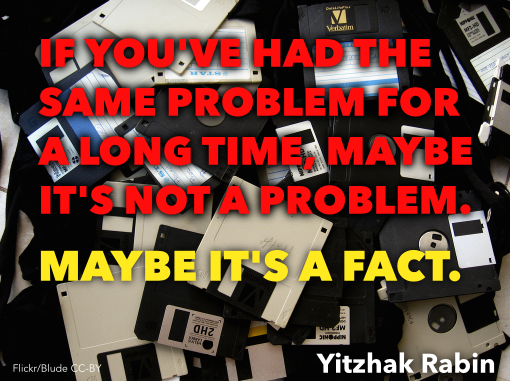
Here's what I think: 'data management' is an impossible fiction. A fairy tale.

You can't manage data

I'm talking to you, big-company-data-management-person.

Data is a mess, and it's distributed across your organization (and your partners, and your government, and your data vendors), and it's full of inconsistencies, and people store local copies of everything because of your broken SharePoint permissions, and... data is a mess.

The terrible truth you're fighting is that subsurface data wants to be a mess. Subsurface geoscience is not accounting. It's multi-dimensional. It's interdependent. Some of it is analog. There are dozens, maybe hundreds of formats, many of which are proprietary. Every single thing is unquantifiably uncertain. There are dozens of units. Interpretation generates more data, often iteratively. Your organization won't fund anything to do with IT properly — "We're an oil company, not a technology company!" — but it's OK because VPs only last 2 years. Well, subsurface facts last for decades.

You can't manage data. Try something else.

The principle here is: cope don't fix.

People earnestly trying to manage data reminds me of Yahoo trying to catalog the Internet in 1995. Bizarrely, they're still doing it... for 3 more months anyway. But we all know there's only one way to find things on the web today: search. Search transcends the catalog. 

So what transcends data management? I've got my own ideas, but first I really, really want to know what you think. What's one thing we could do — or stop doing — to make things a bit better?

Free the (seismic) data!

Yesterday afternoon Evan and I hosted the second unsession at the GeoConvention in Calgary. After last year exposing 'Free the data' as one of the unsolved problems in subsurface geoscience, we elected to explore this idea further. And we're addicted to this kind of guided, recorded conversation.

Attendance was a little thin, but those who came spent the afternoon deep in conversation about open data, open software, and greater industry transparency. And we unearthed an exciting and potentially epic conclusion that I hope leads to a small revolution.

What happened?

Rather than leaving the floor completely open, we again brought some structure to the proceedings. I'll post the full version to the wiki page, but here's the overview:

  1. Group seismic interpretation: 5 interpreters in 5 minutes.
  2. Stories about openness: which of 26 short stories resonate with you most?
  3. Open/closed, accessible/inaccessible: a scorecard for petroleum geoscience.
  4. Where are the opportunities? What should we move from closed to open?

As you might expect, the last part was the real point. We wanted to find some high-value areas to poke, or at least gather evidence around. And one area—one data type—was identified as being (a) closed and inaccessible in Canada and (b) much more impactful if it were open and accessible. I gave the punchline away in the title, but that data type is seismic data.

Open, public seismic data is much too juicy a topic to do justice to in this post, so stay tuned for a review of some the specifics of how that conversation went. Meanwhile, imagine a world with free, public seismic data...

Reflections on the 2nd edition

The afternoon went well, and the outcome was intriguing, but we were definitely disappointed by the turnout. We have multiple working hypotheses about it...

  • There may not be a strong appetite for this sort of session, especially on a 'soft' topic. Next time: seismic resolution?
  • The first day might not be the best time for it, because people are still in the mood for talks. Next time: Wednesday morning?
  • The programme maybe didn't reflect what the unsession was about, and the time was unclear. Next time: More visibility.
  • Three hours may be too much to ask from people, though you could say the same about any other session here.

We'd love to hear your thoughts too... Are we barking up completely the wrong tree? Does our community even want to have these conversations? Should we try again in 2015?

Private public data

Our recent trip to the AAPG Annual Convention in Houston was much enhanced by meeting some inspiring geoscientist–programmers. People like...

  • Our old friend Jacob Foshee hung out with us and built his customary awesomeness.
  • Wassim Benhallam, at the University of Utah, came to our Rock Hack and impressed everyone with his knowledge of clustering algorithms, and sedimentary geology.
  • Sebastian Good, of Palladium Consulting, is full of beans and big ideas — and is a much more accomplished programmer than most of us will ever be. If you're coding geoscience, you'll like his blog.
  • We had a laugh with Nick Thompson from Schlumberger, who we bumped into at a 100% geeky meet-up for Python programmers interested in web sockets. I cannot explain why we were there.

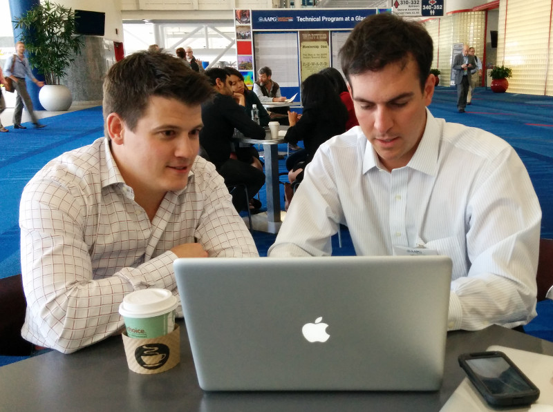
Perhaps the most animated person we met was Ted Kernan (right). A recent graduate of Colorado School of Mines, Ted has taught himself PHP, one of the most prevalent programming languages on the web (WordPress, Joomla, and MediaWiki are written in PHP). He's also up on all the important bits of web tech, like hosting, and HTML frameworks.

But the really cool thing is what he's built: a search utility for public well data in the United States. You can go and check it out at publicwelldata.com — and if you like it, let Ted know!

Actually, that's not even the really cool thing. The really cool thing is how passionate he is about exposing this important public resource, and making it discoverable and accessible. He highlights the stark difference between Colorado's easy access to digital well data, complete with well logs, and the sorry state of affairs in North Dakota, where he can't even get his app in to read well names. 'Public data' can no longer mean "we'll sell you a paper printout for $40". It belongs on the web — machines can read too.

More than just wells

There's so much potential power here — not only for human geoscientists looking for well data, but also for geoscientist–programmers building tools that need well data. For example, I imagine being able to point modelr.io at any public well to grab its curves and make a quick synthetic. Ready access to open services like Ted's will free subsurface software from the deadweight of corporate databases filled with years of junk, and make us all a bit more nimble. 

We'll be discussing open data, and openness in general, at the Openness Unsession in Calgary on the afternoon of 12 May — part of GeoConvention 2014. Join us!