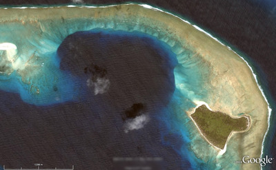
Where on Google Earth #266

Brian nailed Where on Google Earth #265. He doesn't have a blog of his own so he asked me to host it for him. So, over to Brian...

Much thanks go to Matt here for hosting this WoGE for me since I do not yet have a blog of my own. I'm already looking into options. This is just too much fun for a Google Earth addict like me.

Although this image is zoomed in pretty good I'll invoke the Schott Rule just to give newcomers like myself a chance. For those unaware, this means you must wait one hour for each previous WoGE win before you can post your answer. [Here are the previous winners in Ron Schott's KML file — Matt].

I've also hidden the orientation compass so you can safely assume North isn't necessarily at top. Can't make it too easy now, can we?

This one isn't just about the geology, but also the historical significance.

Please post responses in the comments. Posted at 0800 Atlantic, 1200 GMT.

B is for bit depth

If you give two bits about quantitative seismic interpretation, amplitude maps, inversion, or AVO, then you need to know a bit about bits.

When seismic data is recorded, four bytes are used to store the amplitude values. A byte contains 8 bits, so four of them means 32 bits for every seismic sample, or a bit-depth of 32. As Evan explained recently, amplitude values themselves don’t mean much. But we want to use 32 bits because, at least at the field recording stage, when a day might cost hundreds of thousands of dollars, we want to capture every nuance of the seismic wavefield, including noise, multiples, reverberations, and hopefully even some signal. We have time during processing to sort it all out.

First, it’s important to understand that I am not talking about spatial or vertical resolution, what we might think of as detail. That’s a separate problem which we can understand by considering a pixelated image. It has poor resolution: it is spatially under-sampled. Here is the same image at two different resolutions. The one on the left is 300 × 240 pixels; on the right, 80 × 64 pixels (but reproduced at the same size as the other picture, so the pixels are larger). Click to read more...

Read More

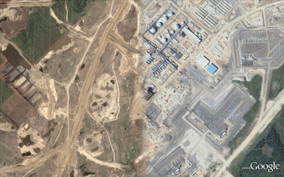
Where on Google Earth #265

After correctly but illegally identifying Ole's hellish Afar Triangle in WoGE #264 over at And The Water Seems Inviting, I hereby give you number 265 in this long-running geoscience quiz game started by Clastic Detritus

Where on Google Earth is the best use of a computer and some spare time since SETI@home. If you are new to the game, it is easy to play. The winner is the first person to examine the picture below, find the location (name, link, or lat-long), and give a brief explanation of its geological interest. Please post your answer in the comments below. And thanks to the Schott Rule, which I am invoking, newbies have a slight edge: previous winners must wait one hour for each previous win before playing.

So: where and what on Google earth is this? [Posted at 1303 GMT]

Great geophysicists #2: Snellius

Willebrordus Snellius (1580–1626) was the Latin name that Dutchman Willebrord Snel van Royen, or plain Snell, used for all of his publications as a mathematician. He made great advances over his predessors by introducing trigonometric methods for measuring large distances across landcapes. He's regarded as the father of triangulation, which is widely applied in surveying, imaging, and event location. And he even tried to measure the radius of the earth.

His most famous contribution, Snell's law of refraction, has formed the basis of geometrical optics and is inherently ingrained in seismology. Snell's law is used to determine the direction of wave propagation through a refractive interface:  
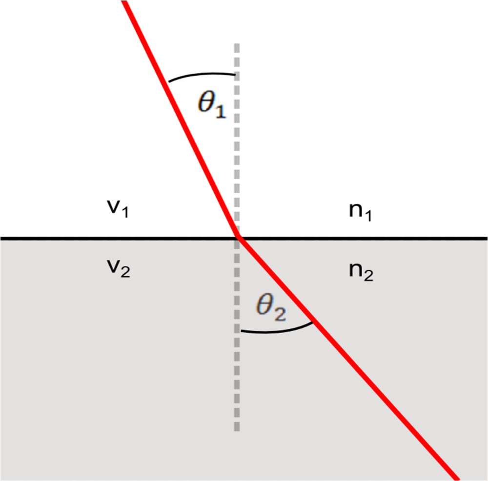
How much waves bend depends on the ratio of velocities between the two media v2/ v1. You will notice that the right hand side of this equation is where Ibn Sahl left off.

Other mathematicians before him, Ibn Sahl for instance, were aware that light rays refracted when they entered media of different velocities, but Snellius was the first to describe this problem using trigonometry. He made his discovery in 1621, when he was 41 years old, but it was never published in his lifetime. René Descartes, the inventor of the cartesian coordinate and analytical geometry, published this law of refraction 16 years after Snell's death, as Descarte's law of refraction. But Snell was eventually widely attributed with the discovery in 1703 when Christiaan Huygens published Snell's results in his Dioptrica to explain, among other things why successive wavefronts travel in parallel.
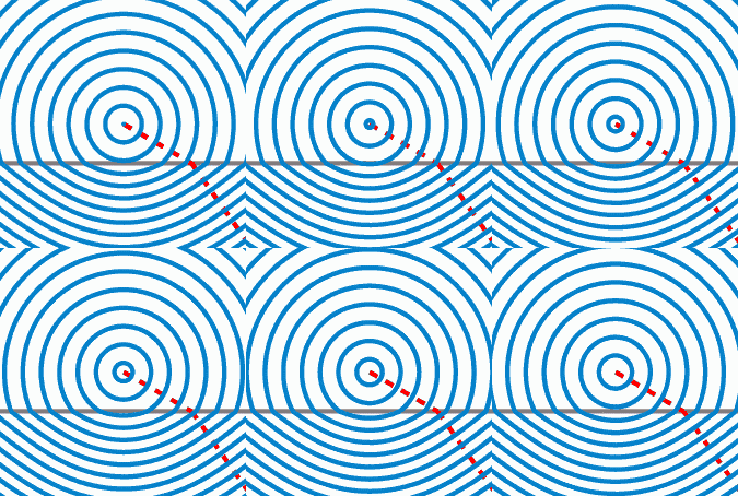
Oleg Alexandrov via Wikipedia

In a classic analogy, a 'fast' region is the beach, a ' slow' region is the water, and the fastest way for a rescuer on the beach to get to a drowning person in the water is to run, then swim, along a path that follows Snell's law. The path a ray will take upon entering a media is the one that minimzes the travel time through that media (see Fermat's principle). Notice too that there are no arrows indicating the direction of ray propagation: whether the ray enters from above or below, the refraction behaviour is the same.

In seismology, Snell's law is used to describe how seismic waves bend and turn in accordance with contrasting velocities in the subsurface which is the foundation of surveying, image focusing, and event detection. It appears in ray-tracing, ray-parameterization, offset to angle estimations (used in AVO), anisotropy problems, velocity modeling, and traveltime tomography. Snellius, we salute you!