News of the week

We hope you're having a great summer. Our website has been quieter than usual this week, but we're busy building things—stay tuned. And we haven't done a news post for a few weeks, so here are some things that have caught our eye.

A new imaging paradigm

Lytro has begun what may be a revolution for photography with the light field camera, putting the choice of the focal point and depth of field in the hands of the viewer, not the photographer. Try it yourself: click on these examples to change the focal point of the images.

The radical new sensor works by not only capturing the intensity of light, but also its direction. This means the full visual field can be reconstructed. You can view the inspiring gallery of dynamic images or read more about the methods behind computational photography from Ian Hopkinson's blog post. The analogy to full wavefield imaging is obvious, but perhaps the most exciting story is not the technology, but the shift of control from imager (processor) to viewer (interpreter). 

Don't compress the data, expand the medium

Wolfram, makers of Mathematica among other things, are a deeply innovative bunch. This week they launched the Computable Document Format, or CDF, for interactive documents. These new documents could make reports, presentations, e-textbooks, and journal articles much more interesting. 

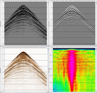
INT releases Geo Toolkit 4.2

Interactive Network Technologies, makers of the INTViewer interpretation software, have released a new version of its GeoToolkit, version 4.2. It's a proprietary C++ library for developers of geoscience software, and is used by many of the major exploration companies. New features include

  • Improved Seismic display with support for anti-aliasing, transparency, and image rotation
  • New indexed seismic data support for rapid access of large datasets
  • Enhancements to Chart libraries, including multiple selection within charts and ability to link charts.

TimeScale Creator gets a major upgrade

We have written before about this handy application from a Purdue consortium; it should be in every geoscientist's toolbox. Keep an eye out over the summer and fall for new datapacks (including Arctic Canada, Australia, NE Russia), and an all-new web version. Version 5 has some great enhancements:

  • A new data input format, and some limits on user data in the free version
  • Database and display improvements for humanoids, dinocycsts, and passive margins, plus new datapacks
  • Improved geographic interface, now with index maps

This regular news feature is for information only. We aren't connected with any of these organizations, and don't necessarily endorse their products or services.

More powertools, and a gobsmacking

Yesterday was the second day of the open geophysics software workshop I attended in Houston. After the first day (which I also wrote about), I already felt like there were a lot of great geophysical powertools to follow up on and ideas to chase up, but day two just kept adding to the pile. In fact, there might be two piles now.

First up, Nick Vlad from FusionGeo gave us another look at open source systems from a commercial processing shop's perspective. Along with Alex (on day 1) and Renée (later on), he gave plenty of evidence that open source is not only compatible with business, but it's good for business. FusionGeo firmly believe that no one package can support them exclusively, and showed us GeoPro, their proprietary framework for integrating SEPlib, SU, Madagascar, and CP Seis. 

SEP logoYang Zhang from Stanford then showed us how reproducibility is central to SEPlib (as it is to Madagascar). When possible, researchers in the Stanford Exploration Project build figures with makefiles, which can be run by anyone to easily reproduce the figure. When this is not possible, a figure is labelled as non-reproducible; if there are some dependencies, on data for example, then it is called conditionally reproducible. (For the geeks out there, the full system for implementing this involves SEPlib, GNU make, Vplot, LaTeX, and SCons). 

Next up was a reproducibility system with ancestry in SEPlib: Madagascar, presented by the inimitable Sergey Fomel. While casually downloading and compiling Madagascar, he described how it allows for quick regeneration of figures, even from other sources like Mathematica. There are some nice usability features of Madagascar: you can easily interface with processes using Python (as well as Java, among other languages), and tools like OpendTect and BotoSeis can even provide a semi-graphical interface. Sergey also mentioned the importance of a phenomenon called dissertation procrastination, and why grad students sometimes spend weeks writing amazing code:

"Building code gives you good feelings: you can build something powerful, and you make connections with the people who use it"

After the lunch break, Joe Dellinger from BP explained how he thought some basic interactivity could be added to Vplot, SEP's plotting utility. The goal would not be to build an all-singing, all-dancing graphics tool, but to incrementally improve Vplot to support editing labels, changing scales, and removing elements. A good goal for a 1-day hack-fest?

The show-stopper of the day was Bjorn Olofsson of SeaBird Exploration. I think it's fair to say that everyone was gobsmacked by his description of SeaSeis, a seismic processing system that he has built with his own bare hands. This was the first time he has presented the system, but he started the project in 2005 and open-sourced it about 18 months ago. Bjorn's creation stemmed from an understandable (to me) frustration with other packages' apparent complexity and unease-of-use. He has built enough geophysical algorithms for SeaBird to use the software at sea, but the real power is in his interactive viewing tools. Built with Java, Bjorn has successfully exploited all the modern GUI libraries at his disposal. Due to constraints on his time, the future is uncertain. Message of the day: Help this man!

Renée Bourque of dGB also opened a lot of eyes with her overview of OpendTect and the Open Seismic Repository. dGB's tools are modern, user-friendly, and flexible. I think many people present realized that these tools—if combined with the depth and breadth of more fundamental pieces like SU, SEPlib and Madagascar—could offer the possibility of a robust, well-supported, well-documented, and rich environment that processors can use every day, without needing a lot of systems support or hacking skills. The paradigm already exists: Madagascar has an interface in OpendTect today.

As the group began to start thinking about the weekend, it was left to me, Matt Hall, to see if there was any more appetite for hearing about geophysics and computers. There was! Just enough for me to tell everyone a bit about mobile devices, the Android operating system, and the App Inventor programming canvas. More on this next week!

It was an inspiring and thought-provoking workshop. Thank you to Karl Schleicher and Robert Newsham for organizing, and Cheers! to the new friends and acquaintances. My own impression was that the greatest challenge ahead for this group is not so much computational, but more about integration and consolidation. I'm looking forward to the next one!

Open seismic processing, and dolphins

Today was the first day of the Petroleum Technology Transfer Council's workshop Open software for reproducible computational geophysics, being held at the Bureau of Economic Geology's Houston Research Center and organized skillfully by Karl Schleicher of the University of Texas at Austin. It was a full day of presentations (boo!), but all the presentations had live installation demos and even live coding (yay!). It was fantastic. 

Serial entrepreneur Alex Mihai Popovici, the CEO of Z-Terra, gave a great, very practical, overview of the relative merits of three major seismic processing packages: Seismic Unix (SU), Madagascar, and SEPlib. He has a very real need: delivering leading edge seismic processing services to clients all over the world. He more or less dismissed SEPlib on the grounds of its low development rate and difficulty of installation. SU is popular (about 3300 installs) and has the best documentation, but perhaps lacks some modern imaging algorithms. Madagascar, Alex's choice, has about 1100 installs, relatively terse self-documentation (it's all on the wiki), but is the most actively developed.

The legendary Dave Hale (I think that's fair), Colorado School of Mines, gave an overview of his Mines Java Toolkit (JTK). He's one of those rare people who can explain almost anything to almost anybody, so I learned a lot about how to manage parallelization in 2D and 3D arrays of data, and how to break it. Dave is excited about the programming language Scala, a sort of Java lookalike (to me) that handles parallelization beautifully. He also digs Jython, because it has the simplicity and fun of Python, but can incorporate Java classes. You can get his library from his web pages. Installing it on my Mac was a piece of cake, needing only three terminal commands: 

  • svn co http://boole.mines.edu/jtk
  • cd jtk/trunk
  • ant

Chuck Mosher of ConocoPhillips then gave us a look at JavaSeis, an open source project that makes handling prestack seismic data easy and very, very fast. It has parallelization built into it, and is perfect for large, modern 3D datasets and multi-dimensional processing algorithms. His take on open source in commerce: corporations are struggling with the concept, but "it's in their best interests to actively participate".

Eric Jones is CEO of Enthought, the innovators behind (among other things) NumPy/SciPy and the Enthought Python Distribution (or EPD). His take on the role of Python as an integrator and facilitator, handling data traffic and improving usability for the legacy software we all deal with, was practical and refreshing. He is not at all dogmatic about doing everything in Python. He also showed a live demo of building a widget with Traits and Chaco. Awesome.

After lunch, BP's Richard Clarke told us about the history and future of FreeUSP and FreeDDS, a powerful processing system. FreeDDS is being actively developed and released gradually by BP; indeed, a new release is due in the next fews days. It will eventually replace FreeUSP. Richard and others also mentioned that Randy Selzler is actively developing PSeis, the next generation of this processing system (and he's looking for sponsors!). 

German Garabito of the Federal University of Parà, Brazil, generated a lot of interest in BotoSeis, the GUI he has developed to help him teach SU. It allows one to build and manage processing flows visually, in a Java-built interface inspired by Focus, ProMax and other proprietary tools. The software is named after the Amazon river dolphin, or boto (left). Dave Hale described his efforts as the perfect example of the triumph of 'scratching your own itch'.

Continuing the usability theme, Karl Schleicher followed up with a nice look at how he is building scripts to pull field data from the USGS online repository, and perform SU and Madagascar processing flows on them. He hopes he can build a library of such scripts as part of Sergey Fomel's reproducible geophysics efforts. 

Finally, Bill Menger of Global Geophysical told the group a bit about two projects he open sourced when he was at ConocoPhillips: GeoCraft and CPSeis. His insight on what was required to get them into the open was worth sharing: 

  1. Get permission, using a standard open source license (and don't let lawyers change it!)
  2. Communicate the return on investment carefully: testing, bug reporting, goodwill, leverage, etc.
  3. Know what you want to get out of it, and have a plan for how to get there
  4. Pick a platform: compiler, dependencies, queueing, etc (unless you have a lot of time for support!)
  5. Know the issues: helping users, dealing with legacy code, dependency changes, etc.

I am looking forward to another awesome-packed data tomorrow. My own talk is the wafer-thin mint at the end!